, facing west.
More at The Schumin Web:
www.schuminweb.com/2024/06/12/a-weekend-loop-trip/
Ben Schumin is a professional photographer who captures the intricacies of daily life. This image is all rights reserved. Contact me directly for licensing information.")
Ben Schumin Photography Portfolio
Ben Schumin is a professional photographer who captures the intricacies of daily life.
Aerial view of Thornburg, Virginia from just north of Mudd Tavern Road (VA 606), facing west.


![Martin's Caterers [01]](../../../../i/upload/2024/07/17/20240717231107-4ca42930-sq.jpg)
![Martin's Caterers [02]](../../../../i/upload/2024/07/17/20240717231110-54996ec3-sq.jpg)
![Western Maryland Scenic Railroad yard and shops [02]](../../../../i/upload/2024/07/18/20240718215928-fb4fb25c-sq.jpg)
![Western Maryland Scenic Railroad yard and shops [01]](../../../../i/upload/2024/07/18/20240718220124-d410b122-sq.jpg)
![Sign for The Inn at Afton [01]](../../../../i/upload/2024/07/18/20240718222848-077f9d3e-sq.jpg)
![Sign for The Inn at Afton [03]](../../../../i/upload/2024/07/18/20240718222851-7eca0e26-sq.jpg)

![Sign for The Inn at Afton [02]](../../../../i/upload/2024/07/18/20240718222859-c624a23c-sq.jpg)
![Sign for The Inn at Afton [04]](../../../../i/upload/2024/07/18/20240718222906-1840e69e-sq.jpg)
![Pro-Trump graffiti [01]](../../../../i/upload/2024/07/18/20240718222916-c27d8929-sq.jpg)


![Pro-Trump graffiti [02]](../../../../i/upload/2024/07/18/20240718222931-f56c48a8-sq.jpg)

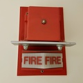
![Fire alarm pull station at Geisinger Community Medical Center [01]](../../../../i/upload/2024/07/18/20240718230731-877f7647-sq.jpg)
![Fire alarm pull station at Geisinger Community Medical Center [02]](../../../../i/upload/2024/07/18/20240718230735-0b9d7236-sq.jpg)
![Ondura water tower [01]](../../../../i/upload/2024/07/19/20240719093801-c95e94f9-sq.jpg)
![Ondura water tower [02]](../../../../i/upload/2024/07/19/20240719093821-34fffbd8-sq.jpg)
![Sign for Turf Motel [01]](../../../../i/upload/2024/07/19/20240719105135-cf488fe7-sq.jpg)
![Sign for Turf Motel [02]](../../../../i/upload/2024/07/19/20240719105140-ae1e9541-sq.jpg)
![Sign for Turf Motel [03]](../../../../i/upload/2024/07/19/20240719105145-b1c2c92e-sq.jpg)
![Sign for Turf Motel [04]](../../../../i/upload/2024/07/19/20240719105156-e7d1b8d6-sq.jpg)
![Sign for Turf Motel [05]](../../../../i/upload/2024/07/19/20240719105201-f579f161-sq.jpg)
![Sign for Turf Motel [06]](../../../../i/upload/2024/07/19/20240719105546-b0b48763-sq.jpg)

![Exit sign at South Mountain rest area [01]](../../../../i/upload/2024/07/19/20240719122919-930ba30b-sq.jpg)
![Exit sign at South Mountain rest area [03]](../../../../i/upload/2024/07/19/20240719122923-c26813d4-sq.jpg)
![Exit sign at South Mountain rest area [02]](../../../../i/upload/2024/07/19/20240719122928-5400c48b-sq.jpg)
![Emergency lighting at South Mountain rest area [01]](../../../../i/upload/2024/07/19/20240719122938-599d96e7-sq.jpg)
![Emergency lighting at South Mountain rest area [02]](../../../../i/upload/2024/07/19/20240719122942-cb6229f4-sq.jpg)
![Demolition of North Creek pool [01]](../../../../i/upload/2024/07/19/20240719123658-1110a1d6-sq.jpg)
![Demolition of North Creek pool [02]](../../../../i/upload/2024/07/19/20240719123702-423a7a28-sq.jpg)
![Demolition of North Creek pool [03]](../../../../i/upload/2024/07/19/20240719123707-916ced30-sq.jpg)
![Demolition of North Creek pool [04]](../../../../i/upload/2024/07/19/20240719123712-8542f958-sq.jpg)
![Demolition of North Creek pool [05]](../../../../i/upload/2024/07/19/20240719123716-2a313fab-sq.jpg)
![Demolition of North Creek pool [06]](../../../../i/upload/2024/07/19/20240719123720-2e9b9ec5-sq.jpg)
![Demolition of North Creek pool [07]](../../../../i/upload/2024/07/19/20240719123725-ffd9b078-sq.jpg)
![Demolition of North Creek pool [08]](../../../../i/upload/2024/07/19/20240719123730-e6ffe7ad-sq.jpg)
![Demolition of North Creek pool [09]](../../../../i/upload/2024/07/19/20240719123734-edad4a9e-sq.jpg)
![Demolition of North Creek pool [10]](../../../../i/upload/2024/07/19/20240719123739-f3fbb25a-sq.jpg)
![Demolition of North Creek pool [11]](../../../../i/upload/2024/07/19/20240719123744-589c5d88-sq.jpg)
![Demolition of North Creek pool [12]](../../../../i/upload/2024/07/19/20240719123749-11dc1d8c-sq.jpg)
![Demolition of North Creek pool [13]](../../../../i/upload/2024/07/19/20240719123754-356fd50e-sq.jpg)
![Demolition of North Creek pool [14]](../../../../i/upload/2024/07/19/20240719123758-bba1b619-sq.jpg)
![Demolition of North Creek pool [15]](../../../../i/upload/2024/07/19/20240719123802-03a1e00b-sq.jpg)
![Demolition of North Creek pool [16]](../../../../i/upload/2024/07/19/20240719123807-dd1e3496-sq.jpg)
![Demolition of North Creek pool [17]](../../../../i/upload/2024/07/19/20240719123811-c3253c43-sq.jpg)
![Demolition of North Creek pool [18]](../../../../i/upload/2024/07/19/20240719123816-ecf6c784-sq.jpg)
![Augusta Health [01]](../../../../i/upload/2024/07/19/20240719160855-824135b4-sq.jpg)
![Augusta Health [02]](../../../../i/upload/2024/07/19/20240719160956-4abb0303-sq.jpg)
![Augusta Health [03]](../../../../i/upload/2024/07/19/20240719161015-deb598b8-sq.jpg)
![Augusta Health [04]](../../../../i/upload/2024/07/19/20240719161030-9bf0dda8-sq.jpg)
![Augusta Health [05]](../../../../i/upload/2024/07/19/20240719161042-6c5b9b56-sq.jpg)
![Augusta Health [06]](../../../../i/upload/2024/07/19/20240719161057-e3240baf-sq.jpg)
![Augusta Health [07]](../../../../i/upload/2024/07/19/20240719161105-0bcbe8bb-sq.jpg)
![Augusta Health [08]](../../../../i/upload/2024/07/19/20240719161113-98f0d2bb-sq.jpg)
![Augusta Health [09]](../../../../i/upload/2024/07/19/20240719161127-66fda87a-sq.jpg)
![Zero Effluent Discharge sign at Ivy rest area [02]](../../../../i/upload/2024/07/19/20240719165901-5f1abe0b-sq.jpg)
![Zero Effluent Discharge sign at Ivy rest area [01]](../../../../i/upload/2024/07/19/20240719165907-357f8f51-sq.jpg)
![NTT Global Data Centers Ashburn facility [01]](../../../../i/upload/2024/07/19/20240719171052-35041993-sq.jpg)
![NTT Global Data Centers Ashburn facility [02]](../../../../i/upload/2024/07/19/20240719171057-d0efa00b-sq.jpg)
![NTT Global Data Centers Ashburn facility [03]](../../../../i/upload/2024/07/19/20240719171101-8a5fb4da-sq.jpg)
![NTT Global Data Centers Ashburn facility [04]](../../../../i/upload/2024/07/19/20240719171106-8c660414-sq.jpg)
![NTT Global Data Centers Ashburn facility [05]](../../../../i/upload/2024/07/19/20240719171110-d52a59b5-sq.jpg)
![NTT Global Data Centers Ashburn facility [06]](../../../../i/upload/2024/07/19/20240719171115-7cdebdb3-sq.jpg)
![Industrial waterfront in Camden, New Jersey [01]](../../../../i/upload/2024/07/19/20240719174524-f25fe5ac-sq.jpg)
![Industrial waterfront in Camden, New Jersey [04]](../../../../i/upload/2024/07/19/20240719174533-7b9410c9-sq.jpg)
![Industrial waterfront in Camden, New Jersey [03]](../../../../i/upload/2024/07/19/20240719174542-ae316f93-sq.jpg)
![EMR Metal Recycling facility [06]](../../../../i/upload/2024/07/19/20240719174626-98ec08f4-sq.jpg)
![EMR Metal Recycling facility [05]](../../../../i/upload/2024/07/19/20240719174746-6f4e378f-sq.jpg)
![Industrial waterfront in Camden, New Jersey [05]](../../../../i/upload/2024/07/19/20240719174750-f22c4df0-sq.jpg)
![EMR Metal Recycling facility [01]](../../../../i/upload/2024/07/19/20240719174859-4276da73-sq.jpg)
![EMR Metal Recycling facility [04]](../../../../i/upload/2024/07/19/20240719174903-e0c5d94c-sq.jpg)
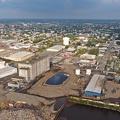
![Industrial waterfront in Camden, New Jersey [02]](../../../../i/upload/2024/07/19/20240719175008-c02bd1f1-sq.jpg)
![EMR Metal Recycling facility [02]](../../../../i/upload/2024/07/19/20240719175012-f06644ca-sq.jpg)
![EMR Metal Recycling facility [03]](../../../../i/upload/2024/07/19/20240719175016-8297b2ce-sq.jpg)


![El-Roy Fire Department Training Center [02]](../../../../i/upload/2024/07/19/20240719201040-d0114553-sq.jpg)
![El-Roy Fire Department Training Center [03]](../../../../i/upload/2024/07/19/20240719201141-1c6993f9-sq.jpg)
![El-Roy Fire Department Training Center [01]](../../../../i/upload/2024/07/19/20240719201341-2d68bf24-sq.jpg)
![Toilet at Taco Bell in Fredericksburg, Virginia [02]](../../../../i/upload/2024/07/19/20240719211119-bdde33ac-sq.jpg)
![Toilet at Taco Bell in Fredericksburg, Virginia [01]](../../../../i/upload/2024/07/19/20240719211125-f404defe-sq.jpg)
![Shady Grove rail yard [01]](../../../../i/upload/2024/07/19/20240719211525-ca38c79d-sq.jpg)
![Shady Grove rail yard [02]](../../../../i/upload/2024/07/19/20240719211530-77ddc30f-sq.jpg)
![Shady Grove rail yard [03]](../../../../i/upload/2024/07/19/20240719211537-c9526637-sq.jpg)
![Sign at Utz factory [01]](../../../../i/upload/2024/07/19/20240719213206-74b5dade-sq.jpg)
![Sign at Utz factory [02]](../../../../i/upload/2024/07/19/20240719213211-aabfa5f9-sq.jpg)
![Sign at Utz factory [03]](../../../../i/upload/2024/07/19/20240719213216-3889b574-sq.jpg)
![Sign at Utz factory [04]](../../../../i/upload/2024/07/19/20240719213221-27577945-sq.jpg)
![Sign at Utz factory [05]](../../../../i/upload/2024/07/19/20240719213227-e96027d5-sq.jpg)
![Sign at Utz factory [06]](../../../../i/upload/2024/07/19/20240719213233-2bcd8b57-sq.jpg)

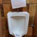
![Restroom at 25 Penncraft Avenue [01]](../../../../i/upload/2024/07/20/20240720015726-04311401-sq.jpg)
![Restroom at 25 Penncraft Avenue [02]](../../../../i/upload/2024/07/20/20240720015731-e25542f1-sq.jpg)

![Elyse photographs in the Mormon Temple [01]](../../../../i/upload/2024/07/20/20240720093404-82648ff0-sq.jpg)
![Elyse photographs in the Mormon Temple [02]](../../../../i/upload/2024/07/20/20240720093408-192d18ee-sq.jpg)
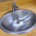
![Sink at the Mormon Temple [01]](../../../../i/upload/2024/07/20/20240720093412-b31dccfb-sq.jpg)
![Sink at the Mormon Temple [02]](../../../../i/upload/2024/07/20/20240720093417-bc639286-sq.jpg)
![Fire alarm strobe at the Mormon Temple [01]](../../../../i/upload/2024/07/20/20240720093421-587a7952-sq.jpg)
![Fire alarm strobe at the Mormon Temple [02]](../../../../i/upload/2024/07/20/20240720093425-bf72e0ad-sq.jpg)
![Fire alarm strobe at the Mormon Temple [03]](../../../../i/upload/2024/07/20/20240720093430-272588d1-sq.jpg)
![Fire alarm strobe at the Mormon Temple [04]](../../../../i/upload/2024/07/20/20240720093434-b53f3b9b-sq.jpg)

![Hollister facility in Stuarts Draft, Virginia [01]](../../../../i/upload/2024/07/20/20240720094417-069ab782-sq.jpg)
![Hershey Chocolate of Virginia [01]](../../../../i/upload/2024/07/20/20240720094519-ccad131b-sq.jpg)
![Hershey Chocolate of Virginia [04]](../../../../i/upload/2024/07/20/20240720094524-ccc73469-sq.jpg)
![Hershey Chocolate of Virginia [08]](../../../../i/upload/2024/07/20/20240720094530-e4feb574-sq.jpg)
![Hershey Chocolate of Virginia [03]](../../../../i/upload/2024/07/20/20240720094541-52997d61-sq.jpg)
![Hershey Chocolate of Virginia [05]](../../../../i/upload/2024/07/20/20240720094546-e276556f-sq.jpg)
![Hershey Chocolate of Virginia [06]](../../../../i/upload/2024/07/20/20240720094552-04a41f1a-sq.jpg)
![Hershey Chocolate of Virginia [02]](../../../../i/upload/2024/07/20/20240720094557-5fb236fe-sq.jpg)
![Hershey Chocolate of Virginia [07]](../../../../i/upload/2024/07/20/20240720094603-ad5a0629-sq.jpg)
![Hollister facility in Stuarts Draft, Virginia [02]](../../../../i/upload/2024/07/20/20240720094608-5c83c54b-sq.jpg)
![Sewage Eggs [02]](../../../../i/upload/2024/07/20/20240720100415-3f7801c1-sq.jpg)
![Sewage Eggs [01]](../../../../i/upload/2024/07/20/20240720100421-5bfc7021-sq.jpg)


![Verona, Virginia over Mill Place Commerce Park [03]](../../../../i/upload/2024/07/20/20240720110718-2e216a1d-sq.jpg)
![Bush’s Visitor Center [01]](../../../../i/upload/2024/07/20/20240720120249-4d408b02-sq.jpg)
![Bush’s Visitor Center [02]](../../../../i/upload/2024/07/20/20240720120532-fc07688b-sq.jpg)
![Bush’s Visitor Center [03]](../../../../i/upload/2024/07/20/20240720120603-4db366fe-sq.jpg)
![Bush’s Visitor Center [04]](../../../../i/upload/2024/07/20/20240720120620-5264d1e8-sq.jpg)
![Bush’s Visitor Center [05]](../../../../i/upload/2024/07/20/20240720120635-2e2d6231-sq.jpg)
![Bush’s Visitor Center [06]](../../../../i/upload/2024/07/20/20240720120650-b3699ff0-sq.jpg)
![Bush’s Visitor Center [07]](../../../../i/upload/2024/07/20/20240720120704-7b5100e5-sq.jpg)
![Bush’s Visitor Center [08]](../../../../i/upload/2024/07/20/20240720120719-a90a9257-sq.jpg)
![Bush’s Visitor Center [09]](../../../../i/upload/2024/07/20/20240720120733-94d12db1-sq.jpg)
![Bush’s Visitor Center [10]](../../../../i/upload/2024/07/20/20240720120747-203fe156-sq.jpg)
![Bush’s Visitor Center [11]](../../../../i/upload/2024/07/20/20240720120802-5173055a-sq.jpg)
![Bush’s Visitor Center [12]](../../../../i/upload/2024/07/20/20240720120811-e5efb7e5-sq.jpg)
![Bush’s Visitor Center [13]](../../../../i/upload/2024/07/20/20240720120819-bae673b8-sq.jpg)
![Bush’s Visitor Center [14]](../../../../i/upload/2024/07/20/20240720120824-ae171fa4-sq.jpg)
![Bush’s Visitor Center [15]](../../../../i/upload/2024/07/20/20240720120829-d1c6d175-sq.jpg)
![Bush’s Visitor Center [16]](../../../../i/upload/2024/07/20/20240720120834-029a0777-sq.jpg)
![Bush’s Visitor Center [17]](../../../../i/upload/2024/07/20/20240720120839-8eaf9956-sq.jpg)
![Bush’s Visitor Center [18]](../../../../i/upload/2024/07/20/20240720120844-46f5c32d-sq.jpg)
![Bush’s Visitor Center [19]](../../../../i/upload/2024/07/20/20240720120848-ec3fda27-sq.jpg)
![Bush’s Visitor Center [20]](../../../../i/upload/2024/07/20/20240720120853-9e85960d-sq.jpg)
![Bush’s Visitor Center [21]](../../../../i/upload/2024/07/20/20240720120858-473e04c2-sq.jpg)

![Carilion Children's Tanglewood Center [01]](../../../../i/upload/2024/07/20/20240720121249-0b3884fe-sq.jpg)
![Carilion Children's Tanglewood Center [04]](../../../../i/upload/2024/07/20/20240720121715-559cf246-sq.jpg)
![Carilion Children's Tanglewood Center [02]](../../../../i/upload/2024/07/20/20240720121731-43ad1716-sq.jpg)
![Carilion Children's Tanglewood Center [03]](../../../../i/upload/2024/07/20/20240720121736-ac653cf8-sq.jpg)
![Intersection of Montgomery Village Avenue and Frederick Avenue [03]](../../../../i/upload/2024/07/20/20240720122556-24460d91-sq.jpg)
![Intersection of Montgomery Village Avenue and Frederick Avenue [04]](../../../../i/upload/2024/07/20/20240720122602-b6ea0f87-sq.jpg)
![Intersection of Montgomery Village Avenue and Frederick Avenue [06]](../../../../i/upload/2024/07/20/20240720122615-c5e58b7b-sq.jpg)
![Intersection of Montgomery Village Avenue and Frederick Avenue [07]](../../../../i/upload/2024/07/20/20240720122622-a14d072e-sq.jpg)
![Intersection of Montgomery Village Avenue and Frederick Avenue [09]](../../../../i/upload/2024/07/20/20240720122635-e4aabe5a-sq.jpg)
![Construction of Progress Labs [01]](../../../../i/upload/2024/07/20/20240720122640-8dc8f02f-sq.jpg)
![Construction of Progress Labs [02]](../../../../i/upload/2024/07/20/20240720122646-9f5697a6-sq.jpg)
![Walkersville Bowling Center [01]](../../../../i/upload/2024/07/20/20240720123835-88663b8a-sq.jpg)
![Walkersville Bowling Center [02]](../../../../i/upload/2024/07/20/20240720123840-611845ca-sq.jpg)
![Intersection of Montgomery Village Avenue and Frederick Avenue [02]](../../../../i/upload/2024/07/20/20240720142751-f6e6a599-sq.jpg)
![Willett Street Industries [05]](../../../../i/upload/2024/07/20/20240720151328-1a0ff066-sq.jpg)
![Willett Street Industries [04]](../../../../i/upload/2024/07/20/20240720151334-3e0900cc-sq.jpg)
![Willett Street Industries [02]](../../../../i/upload/2024/07/20/20240720151344-4f1cdc6b-sq.jpg)
![Willett Street Industries [01]](../../../../i/upload/2024/07/20/20240720151409-4e0be522-sq.jpg)
![Willett Street Industries [06]](../../../../i/upload/2024/07/20/20240720151414-1706282b-sq.jpg)
![Entrance to the Ink Master studio [04]](../../../../i/upload/2024/07/20/20240720151419-6d107e29-sq.jpg)
![Entrance to the Ink Master studio [02]](../../../../i/upload/2024/07/20/20240720151424-ace230bc-sq.jpg)
![Entrance to the Ink Master studio [07]](../../../../i/upload/2024/07/20/20240720151430-15dd5c52-sq.jpg)
![Entrance to the Ink Master studio [05]](../../../../i/upload/2024/07/20/20240720151436-8d2f77da-sq.jpg)

![Entrance to the Ink Master studio [08]](../../../../i/upload/2024/07/20/20240720151504-89eb71bf-sq.jpg)
![Entrance to the Ink Master studio [06]](../../../../i/upload/2024/07/20/20240720151509-8fc03898-sq.jpg)
![Entrance to the Ink Master studio [01]](../../../../i/upload/2024/07/20/20240720151515-81d60dcb-sq.jpg)
![Willett Street Industries [03]](../../../../i/upload/2024/07/20/20240720151520-1f1390da-sq.jpg)
![Entrance to the Ink Master studio [03]](../../../../i/upload/2024/07/20/20240720151549-cc1798aa-sq.jpg)
![Entrance to the Ink Master studio [09]](../../../../i/upload/2024/07/20/20240720151555-21819963-sq.jpg)
![Entrance to the Ink Master studio [10]](../../../../i/upload/2024/07/20/20240720151610-7a5c96f4-sq.jpg)
![Argos USA Martinsburg facility [04]](../../../../i/upload/2024/07/20/20240720152450-369388b7-sq.jpg)
![Argos USA Martinsburg facility [01]](../../../../i/upload/2024/07/20/20240720152454-6c97c135-sq.jpg)
![Argos USA Martinsburg facility [09]](../../../../i/upload/2024/07/20/20240720152458-8cd57e7d-sq.jpg)
![Argos USA Martinsburg facility [02]](../../../../i/upload/2024/07/20/20240720152505-ea792d05-sq.jpg)
![Argos USA Martinsburg facility [05]](../../../../i/upload/2024/07/20/20240720152509-9d4ce1b0-sq.jpg)
![Argos USA Martinsburg facility [03]](../../../../i/upload/2024/07/20/20240720152512-a8e933ce-sq.jpg)
![Argos USA Martinsburg facility [08]](../../../../i/upload/2024/07/20/20240720152516-bbd5a5b9-sq.jpg)
![Argos USA Martinsburg facility [10]](../../../../i/upload/2024/07/20/20240720152522-8dd948e9-sq.jpg)
![Argos USA Martinsburg facility [06]](../../../../i/upload/2024/07/20/20240720152540-ea336225-sq.jpg)
![Argos USA Martinsburg facility [07]](../../../../i/upload/2024/07/20/20240720152544-be1f436c-sq.jpg)

![Dining facility at Camp Ramblewood [02]](../../../../i/upload/2024/07/29/20240729110751-d4cba2de-sq.jpg)
![Dining facility at Camp Ramblewood [01]](../../../../i/upload/2024/07/29/20240729110756-0da417a9-sq.jpg)

![Fire at Aggregate Industries quarry [01]](../../../../i/upload/2024/12/25/20241225002941-9f8a343a-sq.jpg)
![Fire at Aggregate Industries quarry [02]](../../../../i/upload/2024/12/25/20241225002950-4ff900f3-sq.jpg)
![Fire at Aggregate Industries quarry [03]](../../../../i/upload/2024/12/25/20241225002959-22d28c07-sq.jpg)
![Fire at Aggregate Industries quarry [04]](../../../../i/upload/2024/12/25/20241225003009-8b569132-sq.jpg)
![Fire at Aggregate Industries quarry [05]](../../../../i/upload/2024/12/25/20241225003018-cee46523-sq.jpg)
![Fire at Aggregate Industries quarry [06]](../../../../i/upload/2024/12/25/20241225003029-dbba04bc-sq.jpg)
![Fire at Aggregate Industries quarry [07]](../../../../i/upload/2024/12/25/20241225003039-43d93ed2-sq.jpg)
![Fire at Aggregate Industries quarry [08]](../../../../i/upload/2024/12/25/20241225003049-74b14b99-sq.jpg)
![Fire at Aggregate Industries quarry [09]](../../../../i/upload/2024/12/25/20241225003059-a1a180c5-sq.jpg)
![Fire at Aggregate Industries quarry [10]](../../../../i/upload/2024/12/25/20241225003109-05f02075-sq.jpg)
![Fire at Aggregate Industries quarry [11]](../../../../i/upload/2024/12/25/20241225003120-121dc2e6-sq.jpg)
![Fire at Aggregate Industries quarry [12]](../../../../i/upload/2024/12/25/20241225003131-a180fa10-sq.jpg)
![Fire at Aggregate Industries quarry [13]](../../../../i/upload/2024/12/25/20241225003140-877ad120-sq.jpg)
![Fire at Aggregate Industries quarry [14]](../../../../i/upload/2024/12/25/20241225003152-bb2adfeb-sq.jpg)
![Fire at Aggregate Industries quarry [15]](../../../../i/upload/2024/12/25/20241225003201-9c9796ad-sq.jpg)
![Fire at Aggregate Industries quarry [16]](../../../../i/upload/2024/12/25/20241225003212-9fa6bddb-sq.jpg)
![Fire at Aggregate Industries quarry [17]](../../../../i/upload/2024/12/25/20241225003221-553c3485-sq.jpg)
![Fire at Aggregate Industries quarry [18]](../../../../i/upload/2024/12/25/20241225003230-9cc5b4d8-sq.jpg)
![Aerial view of Monterey, Virginia [05]](../../../../i/upload/2025/01/02/20250102005946-79efaa38-sq.jpg)
![Former PGI Nonwovens facility in Landisville, New Jersey [01]](../../../../i/upload/2025/01/08/20250108104751-eaec9faf-sq.jpg)
![Former PGI Nonwovens facility in Landisville, New Jersey [02]](../../../../i/upload/2025/01/08/20250108104757-3b5da7c6-sq.jpg)
![Former PGI Nonwovens facility in Landisville, New Jersey [03]](../../../../i/upload/2025/01/08/20250108104802-3d494114-sq.jpg)
![Former PGI Nonwovens facility in Landisville, New Jersey [04]](../../../../i/upload/2025/01/08/20250108104809-cbb8be52-sq.jpg)
![Former PGI Nonwovens facility in Landisville, New Jersey [05]](../../../../i/upload/2025/01/08/20250108104814-a060f8bf-sq.jpg)
![Former PGI Nonwovens facility in Landisville, New Jersey [06]](../../../../i/upload/2025/01/08/20250108104822-938c4c34-sq.jpg)
![Former PGI Nonwovens facility in Landisville, New Jersey [07]](../../../../i/upload/2025/01/08/20250108104827-48d1f3d2-sq.jpg)
![Former PGI Nonwovens facility in Landisville, New Jersey [08]](../../../../i/upload/2025/01/08/20250108104833-22221c41-sq.jpg)
![Former PGI Nonwovens facility in Landisville, New Jersey [09]](../../../../i/upload/2025/01/08/20250108104838-ed2a86dd-sq.jpg)
![Former PGI Nonwovens facility in Landisville, New Jersey [10]](../../../../i/upload/2025/01/08/20250108104844-70225e97-sq.jpg)
![Former PGI Nonwovens facility in Landisville, New Jersey [11]](../../../../i/upload/2025/01/08/20250108104850-e450b8c9-sq.jpg)
![Wastewater treatment plant in Cape May, New Jersey [01]](../../../../i/upload/2025/01/09/20250109210940-b204b120-sq.jpg)
![Wastewater treatment plant in Cape May, New Jersey [02]](../../../../i/upload/2025/01/09/20250109210945-b964cae3-sq.jpg)
![881 Pennsylvania Avenue [01]](../../../../i/upload/2025/02/05/20250205103634-d84fe2df-sq.jpg)
![881 Pennsylvania Avenue [02]](../../../../i/upload/2025/02/05/20250205103641-3b7670fa-sq.jpg)
![881 Pennsylvania Avenue [03]](../../../../i/upload/2025/02/05/20250205103655-835a309c-sq.jpg)
![881 Pennsylvania Avenue [04]](../../../../i/upload/2025/02/05/20250205103705-70ad90ac-sq.jpg)
![881 Pennsylvania Avenue [05]](../../../../i/upload/2025/02/05/20250205103716-dc19f7d1-sq.jpg)
![Water tower at Eastern Shore Forest Products [01]](../../../../i/upload/2025/02/16/20250216104828-1da2e8f2-sq.jpg)
![Water tower at Eastern Shore Forest Products [02]](../../../../i/upload/2025/02/16/20250216104851-53db0227-sq.jpg)

Information
- Author
- Ben Schumin
- Copyright
- All Rights Reserved
- Created on
- Saturday 1 June 2024
- Dimensions
- 8064*4536
EXIF Metadata
DJI FC8282
f/170/100
1/2000
200
0/10
0
- DateTimeOriginal
- 2024:06:01 18:40:03
- DateTimeDigitized
- 2024:06:01 18:40:03
- Make
- DJI
- Model
- FC8282
- ExposureProgram
- 2
- FocalLengthIn35mmFilm
- 24
- FNumber
- 170/100
- ExposureTime
- 1/2000
- ISOSpeedRatings
- 200
- Flash
- 0
- WhiteBalance
- 0
- XResolution
- 720000/10000
- YResolution
- 720000/10000
- ImageWidth
- 8064
- ImageLength
- 4536
- Orientation
- 1
- SamplesPerPixel
- 3
- ExposureBiasValue
- 0/10
- MaxApertureValue
- 153/100
- MeteringMode
- 1
- LightSource
- 10
Powered by Piwigo