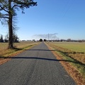
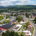
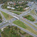
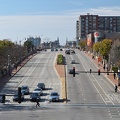
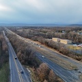
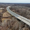
, facing west.
More at The Schumin Web:
www.schuminweb.com/2024/06/12/a-weekend-loop-trip/
Ben Schumin is a professional photographer who captures the intricacies of daily life. This image is all rights reserved. Contact me directly for licensing information.")
Ben Schumin Photography Portfolio
Ben Schumin is a professional photographer who captures the intricacies of daily life.
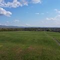
Aerial view of Thornburg, Virginia from just north of Mudd Tavern Road (VA 606), facing west.

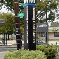
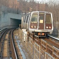
![Benning Road station [01]](../../../i/upload/2024/07/14/20240714171018-fcd1740f-sq.jpg)

![Strickly Enforced 24/7 [02]](../../../i/upload/2024/07/16/20240716011549-2373ae69-sq.jpg)
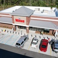
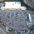
![Northgate Shopping Center [01]](../../../i/upload/2024/07/17/20240717103258-124add55-sq.jpg)
![Northgate Shopping Center [02]](../../../i/upload/2024/07/17/20240717103303-4646396e-sq.jpg)
![Northgate Shopping Center [03]](../../../i/upload/2024/07/17/20240717103307-52741eaf-sq.jpg)

![Forest Springs Drive [01]](../../../i/upload/2024/07/17/20240717154858-173a58a4-sq.jpg)

![Interstate 94 westbound [02]](../../../i/upload/2024/07/17/20240717161211-25917077-sq.jpg)

![Vintage Arby's Big Hat sign in Roanoke, Virginia [01]](../../../i/upload/2024/07/17/20240717174339-42f8bb13-sq.jpg)
![Vintage Arby's Big Hat sign in Roanoke, Virginia [02]](../../../i/upload/2024/07/17/20240717174342-3116e2a5-sq.jpg)
![Vintage Arby's Big Hat sign in Roanoke, Virginia [03]](../../../i/upload/2024/07/17/20240717174345-6665e6e7-sq.jpg)
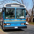
![Montgomery County school buses [01]](../../../i/upload/2024/07/17/20240717174538-640d4399-sq.jpg)
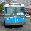
![Montgomery County school buses [02]](../../../i/upload/2024/07/17/20240717174541-7b8c9a6f-sq.jpg)
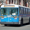
![Montgomery County school buses [03]](../../../i/upload/2024/07/17/20240717174544-43d3ae99-sq.jpg)
![Street signs in Mount Crawford, Virginia [01]](../../../i/upload/2024/07/17/20240717230433-374aad7a-sq.jpg)
![Street signs in Mount Crawford, Virginia [02]](../../../i/upload/2024/07/17/20240717230436-08b6c2b4-sq.jpg)

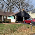
![2931 Weisman Road [01]](../../../i/upload/2024/07/18/20240718213856-45ee5c74-sq.jpg)
![2931 Weisman Road [02]](../../../i/upload/2024/07/18/20240718213900-04ce2433-sq.jpg)
![2931 Weisman Road [03]](../../../i/upload/2024/07/18/20240718213903-820db127-sq.jpg)
![Taco Bell in Aspen Hill during renovation [02]](../../../i/upload/2024/07/18/20240718213909-2a72f309-sq.jpg)
![Taco Bell in Aspen Hill during renovation [01]](../../../i/upload/2024/07/18/20240718213912-eb3c7b3c-sq.jpg)
![Glenmont Metrocentre construction [02]](../../../i/upload/2024/07/18/20240718215424-6aabe67d-sq.jpg)
![Glenmont Metrocentre construction [01]](../../../i/upload/2024/07/18/20240718215428-a61993bf-sq.jpg)

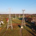
![Power transmission lines in Montgomery Village [06]](../../../i/upload/2024/07/19/20240719002542-992b6062-sq.jpg)
![Power transmission lines in Montgomery Village [05]](../../../i/upload/2024/07/19/20240719002545-bbd1ae24-sq.jpg)
![Power transmission lines in Montgomery Village [04]](../../../i/upload/2024/07/19/20240719002552-1698394d-sq.jpg)
![Power transmission lines in Montgomery Village [03]](../../../i/upload/2024/07/19/20240719002555-701edc67-sq.jpg)
![Power transmission lines in Montgomery Village [02]](../../../i/upload/2024/07/19/20240719002558-88e3b55e-sq.jpg)
![Power transmission lines in Montgomery Village [01]](../../../i/upload/2024/07/19/20240719002602-f6056c42-sq.jpg)
![Ballenger Creek Pike and Mountville Road [01]](../../../i/upload/2024/07/19/20240719093409-99797621-sq.jpg)
![Ballenger Creek Pike and Mountville Road [02]](../../../i/upload/2024/07/19/20240719093414-dcebe5b4-sq.jpg)
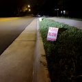
![Speed limit and low ground clearance signs [02]](../../../i/upload/2024/07/19/20240719093418-a79dc78b-sq.jpg)
![Speed limit and low ground clearance signs [01]](../../../i/upload/2024/07/19/20240719093423-402fb975-sq.jpg)

![Former Kmart in Williamsburg, Virginia [01]](../../../i/upload/2024/07/19/20240719101357-7581da75-sq.jpg)
![Former Kmart in Williamsburg, Virginia [02]](../../../i/upload/2024/07/19/20240719101443-948dd990-sq.jpg)
![Former Kmart in Williamsburg, Virginia [03]](../../../i/upload/2024/07/19/20240719101448-4cdeb02c-sq.jpg)
![Former Kmart in Williamsburg, Virginia [04]](../../../i/upload/2024/07/19/20240719101454-0af63f6d-sq.jpg)
![Former Kmart in Williamsburg, Virginia [05]](../../../i/upload/2024/07/19/20240719101458-3e483eb7-sq.jpg)
![Former Kmart in Williamsburg, Virginia [06]](../../../i/upload/2024/07/19/20240719101504-799df051-sq.jpg)
![Former Kmart in Williamsburg, Virginia [07]](../../../i/upload/2024/07/19/20240719101509-76d806a7-sq.jpg)


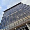
![Springfield Executive Building [01]](../../../i/upload/2024/07/19/20240719104614-e4e726ec-sq.jpg)
![Street sign at Backlick Road and Brookfield Plaza [02]](../../../i/upload/2024/07/19/20240719104619-1bd22298-sq.jpg)
![Street sign at Backlick Road and Brookfield Plaza [01]](../../../i/upload/2024/07/19/20240719104624-32193b87-sq.jpg)
![Springfield Executive Building [02]](../../../i/upload/2024/07/19/20240719104637-ea98597c-sq.jpg)
![Springfield Executive Building [03]](../../../i/upload/2024/07/19/20240719104641-a3016d90-sq.jpg)
![Water tower at Waldorf Volunteer Fire Department [02]](../../../i/upload/2024/07/19/20240719104949-33d7c516-sq.jpg)
![Water tower at Waldorf Volunteer Fire Department [01]](../../../i/upload/2024/07/19/20240719104954-a43f3235-sq.jpg)
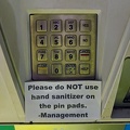
![Bosch fire alarm pull station [01]](../../../i/upload/2024/07/19/20240719105525-e52e0943-sq.jpg)
![Bosch fire alarm pull station [02]](../../../i/upload/2024/07/19/20240719105530-d6d54df1-sq.jpg)
![Bosch fire alarm pull station [03]](../../../i/upload/2024/07/19/20240719105534-c39ad838-sq.jpg)
![Bosch fire alarm pull station [04]](../../../i/upload/2024/07/19/20240719105538-ea3b49fa-sq.jpg)
![Shanghai, unincorporated [04]](../../../i/upload/2024/07/19/20240719105722-198de924-sq.jpg)
![Shanghai, unincorporated [02]](../../../i/upload/2024/07/19/20240719105727-9dd1d509-sq.jpg)
![Shanghai, unincorporated [01]](../../../i/upload/2024/07/19/20240719105732-e7ac53ca-sq.jpg)
![Shanghai, unincorporated [03]](../../../i/upload/2024/07/19/20240719105920-e2c887ea-sq.jpg)
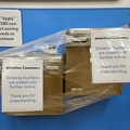
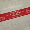
![Social distancing signage at Walmart [01]](../../../i/upload/2024/07/19/20240719110343-400d74fa-sq.jpg)
![Social distancing signage at Walmart [02]](../../../i/upload/2024/07/19/20240719110348-6f4c5923-sq.jpg)
![CarMax in Gaithersburg, Maryland [01]](../../../i/upload/2024/07/19/20240719111533-0c9a00c0-sq.jpg)
![CarMax in Gaithersburg, Maryland [02]](../../../i/upload/2024/07/19/20240719111538-9e395874-sq.jpg)
![Ghost shoes [01]](../../../i/upload/2024/07/19/20240719111639-88b3ad34-sq.jpg)
![Ghost shoes [02]](../../../i/upload/2024/07/19/20240719111643-33096b03-sq.jpg)
![Dead deer on Hungerford Drive [01]](../../../i/upload/2024/07/19/20240719113054-eba7202b-sq.jpg)
![Dead deer on Hungerford Drive [02]](../../../i/upload/2024/07/19/20240719113059-465d7835-sq.jpg)
![Dead deer on Hungerford Drive [03]](../../../i/upload/2024/07/19/20240719113104-1fe20506-sq.jpg)
![Dead deer on Hungerford Drive [04]](../../../i/upload/2024/07/19/20240719113109-b85d4801-sq.jpg)
![Remodel of Walmart Supercenter in Martinsburg, West Virginia [02]](../../../i/upload/2024/07/19/20240719113327-76a9bbe3-sq.jpg)
![Remodel of Walmart Supercenter in Martinsburg, West Virginia [04]](../../../i/upload/2024/07/19/20240719113331-7f61b6dc-sq.jpg)
![Remodel of Walmart Supercenter in Martinsburg, West Virginia [03]](../../../i/upload/2024/07/19/20240719113336-16d17325-sq.jpg)
![Bosch fire alarm pull station [05]](../../../i/upload/2024/07/19/20240719113341-0b414339-sq.jpg)


![Remodel of Walmart Supercenter in Martinsburg, West Virginia [01]](../../../i/upload/2024/07/19/20240719113356-d0732fbf-sq.jpg)
![Brink and Wightman Roads [03]](../../../i/upload/2024/07/19/20240719114723-c9ce5756-sq.jpg)
![Brink and Goshen Roads [03]](../../../i/upload/2024/07/19/20240719114729-e7321e33-sq.jpg)
![Brink and Goshen Roads [01]](../../../i/upload/2024/07/19/20240719114734-e7a24e73-sq.jpg)
![Brink and Goshen Roads [06]](../../../i/upload/2024/07/19/20240719114740-26c54d48-sq.jpg)
![Brink and Goshen Roads [09]](../../../i/upload/2024/07/19/20240719114745-0abbecd0-sq.jpg)
![Brink and Wightman Roads [02]](../../../i/upload/2024/07/19/20240719114750-44efa94d-sq.jpg)
![Brink and Goshen Roads [02]](../../../i/upload/2024/07/19/20240719114755-96e78db3-sq.jpg)
![Brink and Goshen Roads [07]](../../../i/upload/2024/07/19/20240719114800-f7779954-sq.jpg)
![Brink and Goshen Roads [10]](../../../i/upload/2024/07/19/20240719114805-de066605-sq.jpg)
![Barbed wire in Laytonsville, Maryland [02]](../../../i/upload/2024/07/19/20240719114810-85a21e17-sq.jpg)
![Brink and Wightman Roads [01]](../../../i/upload/2024/07/19/20240719114814-00630fe7-sq.jpg)
![Brink and Goshen Roads [04]](../../../i/upload/2024/07/19/20240719114820-366f383a-sq.jpg)
![Brink and Goshen Roads [05]](../../../i/upload/2024/07/19/20240719114825-4168906a-sq.jpg)
![Brink and Goshen Roads [08]](../../../i/upload/2024/07/19/20240719114830-a81c39b1-sq.jpg)
![Thunderbolt siren on Waterloo Road [09]](../../../i/upload/2024/07/19/20240719123009-6c144b95-sq.jpg)
![Thunderbolt siren on Waterloo Road [08]](../../../i/upload/2024/07/19/20240719123015-656c36f8-sq.jpg)
![Thunderbolt siren on Waterloo Road [07]](../../../i/upload/2024/07/19/20240719123021-6280af38-sq.jpg)
![Thunderbolt siren on Waterloo Road [04]](../../../i/upload/2024/07/19/20240719123027-3d68e044-sq.jpg)
![Thunderbolt siren on Waterloo Road [17]](../../../i/upload/2024/07/19/20240719123041-b055bb9b-sq.jpg)
![Thunderbolt siren on Waterloo Road [06]](../../../i/upload/2024/07/19/20240719123051-7e086530-sq.jpg)
![Thunderbolt siren on Waterloo Road [14]](../../../i/upload/2024/07/19/20240719123109-b2ee955c-sq.jpg)
![Thunderbolt siren on Waterloo Road [03]](../../../i/upload/2024/07/19/20240719123119-88946528-sq.jpg)
![Thunderbolt siren on Waterloo Road [02]](../../../i/upload/2024/07/19/20240719123124-850462bc-sq.jpg)
![Thunderbolt siren on Waterloo Road [05]](../../../i/upload/2024/07/19/20240719123140-3aa65998-sq.jpg)
![Thunderbolt siren on Waterloo Road [13]](../../../i/upload/2024/07/19/20240719123150-b08d1dd1-sq.jpg)
![Thunderbolt siren on Waterloo Road [01]](../../../i/upload/2024/07/19/20240719123158-57e8ec06-sq.jpg)
![Thunderbolt siren on Waterloo Road [16]](../../../i/upload/2024/07/19/20240719123203-8a1b2841-sq.jpg)
![Thunderbolt siren on Waterloo Road [15]](../../../i/upload/2024/07/19/20240719123207-a657ac42-sq.jpg)
![Thunderbolt siren on Waterloo Road [12]](../../../i/upload/2024/07/19/20240719123211-e6541c2d-sq.jpg)
![Thunderbolt siren on Waterloo Road [11]](../../../i/upload/2024/07/19/20240719123216-736b1fab-sq.jpg)
![Thunderbolt siren on Waterloo Road [10]](../../../i/upload/2024/07/19/20240719123220-762d0a68-sq.jpg)
![Fire alarm pull station at 12321 Middlebrook Road [01]](../../../i/upload/2024/07/19/20240719153031-01a6bc73-sq.jpg)
![Fire alarm pull station at 12321 Middlebrook Road [02]](../../../i/upload/2024/07/19/20240719153035-ae4064c5-sq.jpg)
![Richmond Avenue in Staunton, Virginia [01]](../../../i/upload/2024/07/19/20240719161158-ddf9fe35-sq.jpg)
![Richmond Avenue in Staunton, Virginia [02]](../../../i/upload/2024/07/19/20240719161203-233bb776-sq.jpg)
![Richmond Avenue in Staunton, Virginia [03]](../../../i/upload/2024/07/19/20240719161212-297c1b53-sq.jpg)

![Traffic signals at US 15 and Lucketts Road [02]](../../../i/upload/2024/07/19/20240719161422-d1e94014-sq.jpg)
![Traffic signals at US 15 and Lucketts Road [01]](../../../i/upload/2024/07/19/20240719161531-79fec9f3-sq.jpg)
![Street signs at intersection of US 15 and Lucketts Road [01]](../../../i/upload/2024/07/19/20240719161537-a75c3dac-sq.jpg)
![Street signs at intersection of US 15 and Lucketts Road [02]](../../../i/upload/2024/07/19/20240719161623-789e37f5-sq.jpg)
![Montgomery County police car on Walker House Road [01]](../../../i/upload/2024/07/19/20240719161838-0781267e-sq.jpg)
![Montgomery County police car on Walker House Road [02]](../../../i/upload/2024/07/19/20240719161844-67fa4055-sq.jpg)
![AT&T Long Lines tower in Finksburg, Maryland [04]](../../../i/upload/2024/07/19/20240719162015-18d88d0a-sq.jpg)
![Walmart in Westminster, Maryland [01]](../../../i/upload/2024/07/19/20240719162019-126d0cd5-sq.jpg)
![AT&T Long Lines tower in Finksburg, Maryland [02]](../../../i/upload/2024/07/19/20240719162027-8757c57d-sq.jpg)
![AT&T Long Lines tower in Finksburg, Maryland [03]](../../../i/upload/2024/07/19/20240719162031-ca91496d-sq.jpg)
![Walmart in Westminster, Maryland [02]](../../../i/upload/2024/07/19/20240719162049-078ff88f-sq.jpg)
![AT&T Long Lines tower in Finksburg, Maryland [01]](../../../i/upload/2024/07/19/20240719162102-ca3a1ec2-sq.jpg)
![AT&T Long Lines tower in Finksburg, Maryland [05]](../../../i/upload/2024/07/19/20240719162107-912e4c89-sq.jpg)
![Walmart in Westminster, Maryland [03]](../../../i/upload/2024/07/19/20240719162115-41d34699-sq.jpg)
![Water tower in Charles Town, West Virginia [02]](../../../i/upload/2024/07/19/20240719162232-1fa6a18a-sq.jpg)
![Water tower in Charles Town, West Virginia [01]](../../../i/upload/2024/07/19/20240719162240-13c189c6-sq.jpg)
![Water tower in Charles Town, West Virginia [04]](../../../i/upload/2024/07/19/20240719162248-f64b8823-sq.jpg)
![Water tower in Charles Town, West Virginia [03]](../../../i/upload/2024/07/19/20240719162312-7a4d222b-sq.jpg)
![Sign for Mike's Country Store [01]](../../../i/upload/2024/07/19/20240719162354-073539d4-sq.jpg)

![Dock lights at Mike's Restaurant & Crabhouse [02]](../../../i/upload/2024/07/19/20240719162439-0bb0019d-sq.jpg)


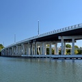
![Bridge carrying Riva Road over the South River [02]](../../../i/upload/2024/07/19/20240719162516-6b4624c8-sq.jpg)
![Marker for slip 42 [01]](../../../i/upload/2024/07/19/20240719162521-b3b6acac-sq.jpg)
![Marker for slip 42 [02]](../../../i/upload/2024/07/19/20240719162526-43487c8e-sq.jpg)


![Dock lights at Mike's Restaurant & Crabhouse [01]](../../../i/upload/2024/07/19/20240719162607-1866de7b-sq.jpg)
![Bridge carrying Riva Road over the South River [01]](../../../i/upload/2024/07/19/20240719162612-4feeeb42-sq.jpg)
![Sign for Mike's Country Store [02]](../../../i/upload/2024/07/19/20240719162617-a18a3534-sq.jpg)

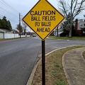
!["Caution: Uncompleted road not publicly maintained" [02]](../../../i/upload/2024/07/19/20240719163609-d3323e61-sq.jpg)
!["Caution: Uncompleted road not publicly maintained" [01]](../../../i/upload/2024/07/19/20240719163632-fc09f3a3-sq.jpg)
![Commercial area south of Interstate 81 in Harrisonburg [01]](../../../i/upload/2024/07/19/20240719163715-46af96f9-sq.jpg)
![Harrisonburg Crossing [01]](../../../i/upload/2024/07/19/20240719163753-972e0345-sq.jpg)
![Commercial area south of Interstate 81 in Harrisonburg [02]](../../../i/upload/2024/07/19/20240719163830-45dce8e7-sq.jpg)
![AT&T Long Lines tower in Dumfries, Virginia [01]](../../../i/upload/2024/07/19/20240719165018-181b846f-sq.jpg)
![AT&T Long Lines tower in Dumfries, Virginia [11]](../../../i/upload/2024/07/19/20240719165024-3f54a696-sq.jpg)
![AT&T Long Lines tower in Dumfries, Virginia [12]](../../../i/upload/2024/07/19/20240719165028-a8de306f-sq.jpg)
![AT&T Long Lines tower in Dumfries, Virginia [18]](../../../i/upload/2024/07/19/20240719165033-46ecd2ea-sq.jpg)
![AT&T Long Lines tower in Dumfries, Virginia [19]](../../../i/upload/2024/07/19/20240719165037-6aedec05-sq.jpg)
![AT&T Long Lines tower in Dumfries, Virginia [26]](../../../i/upload/2024/07/19/20240719165042-05809431-sq.jpg)
![AT&T Long Lines tower in Dumfries, Virginia [28]](../../../i/upload/2024/07/19/20240719165046-236b9515-sq.jpg)
![AT&T Long Lines tower in Dumfries, Virginia [32]](../../../i/upload/2024/07/19/20240719165051-b8547ba1-sq.jpg)
![AT&T Long Lines tower in Dumfries, Virginia [08]](../../../i/upload/2024/07/19/20240719165100-70693200-sq.jpg)
![7-Eleven store in Manassas, Virginia [01]](../../../i/upload/2024/07/19/20240719165104-eac3724d-sq.jpg)
![AT&T Long Lines tower in Dumfries, Virginia [15]](../../../i/upload/2024/07/19/20240719165113-dd2b92c6-sq.jpg)
![AT&T Long Lines tower in Dumfries, Virginia [17]](../../../i/upload/2024/07/19/20240719165117-9cc4e109-sq.jpg)
![AT&T Long Lines tower in Dumfries, Virginia [27]](../../../i/upload/2024/07/19/20240719165122-4f0c71b5-sq.jpg)
![AT&T Long Lines tower in Dumfries, Virginia [02]](../../../i/upload/2024/07/19/20240719165130-484d2461-sq.jpg)
![AT&T Long Lines tower in Dumfries, Virginia [05]](../../../i/upload/2024/07/19/20240719165135-b79f8f02-sq.jpg)
![AT&T Long Lines tower in Dumfries, Virginia [06]](../../../i/upload/2024/07/19/20240719165140-2a22b342-sq.jpg)
![AT&T Long Lines tower in Dumfries, Virginia [30]](../../../i/upload/2024/07/19/20240719165144-01db27aa-sq.jpg)
![7-Eleven store in Manassas, Virginia [03]](../../../i/upload/2024/07/19/20240719165156-06fdf8e6-sq.jpg)
![AT&T Long Lines tower in Dumfries, Virginia [04]](../../../i/upload/2024/07/19/20240719165206-0661e0b6-sq.jpg)
![AT&T Long Lines tower in Dumfries, Virginia [14]](../../../i/upload/2024/07/19/20240719165211-2717f6ed-sq.jpg)
![AT&T Long Lines tower in Dumfries, Virginia [24]](../../../i/upload/2024/07/19/20240719165215-4b689ca2-sq.jpg)
![AT&T Long Lines tower in Dumfries, Virginia [25]](../../../i/upload/2024/07/19/20240719165220-7414049f-sq.jpg)
![7-Eleven store in Manassas, Virginia [02]](../../../i/upload/2024/07/19/20240719165237-29577424-sq.jpg)
![AT&T Long Lines tower in Dumfries, Virginia [03]](../../../i/upload/2024/07/19/20240719165243-ff40438f-sq.jpg)
![AT&T Long Lines tower in Dumfries, Virginia [07]](../../../i/upload/2024/07/19/20240719165247-05d912d2-sq.jpg)
![AT&T Long Lines tower in Dumfries, Virginia [09]](../../../i/upload/2024/07/19/20240719165252-71e4c207-sq.jpg)
![AT&T Long Lines tower in Dumfries, Virginia [10]](../../../i/upload/2024/07/19/20240719165256-4dd53aad-sq.jpg)
![AT&T Long Lines tower in Dumfries, Virginia [13]](../../../i/upload/2024/07/19/20240719165300-ab24e332-sq.jpg)
![AT&T Long Lines tower in Dumfries, Virginia [16]](../../../i/upload/2024/07/19/20240719165305-96fece69-sq.jpg)
![AT&T Long Lines tower in Dumfries, Virginia [20]](../../../i/upload/2024/07/19/20240719165309-3fcea68b-sq.jpg)
![AT&T Long Lines tower in Dumfries, Virginia [21]](../../../i/upload/2024/07/19/20240719165314-ee2dc38f-sq.jpg)
![AT&T Long Lines tower in Dumfries, Virginia [22]](../../../i/upload/2024/07/19/20240719165319-4f23c361-sq.jpg)
![AT&T Long Lines tower in Dumfries, Virginia [23]](../../../i/upload/2024/07/19/20240719165323-e69e47be-sq.jpg)
![AT&T Long Lines tower in Dumfries, Virginia [29]](../../../i/upload/2024/07/19/20240719165327-5e6a211e-sq.jpg)
![AT&T Long Lines tower in Dumfries, Virginia [31]](../../../i/upload/2024/07/19/20240719165332-7037db10-sq.jpg)
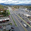
![Montgomery Village, facing approximately west [01]](../../../i/upload/2024/07/19/20240719165409-be458691-sq.jpg)
![Montgomery Village, facing approximately west [02]](../../../i/upload/2024/07/19/20240719165500-7c01f836-sq.jpg)
![Shoes on a power line [01]](../../../i/upload/2024/07/19/20240719165654-4ce50545-sq.jpg)
![Shoes on a power line [02]](../../../i/upload/2024/07/19/20240719165659-84bc17e9-sq.jpg)
![Walmart in Charlottesville, Virginia [01]](../../../i/upload/2024/07/19/20240719171721-a49eed32-sq.jpg)
![Walmart in Charlottesville, Virginia [02]](../../../i/upload/2024/07/19/20240719171727-b2b4e13b-sq.jpg)
![Walmart in Charlottesville, Virginia [03]](../../../i/upload/2024/07/19/20240719171732-3e186d60-sq.jpg)

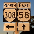
![Reassurance marker for US 460 Business westbound [01]](../../../i/upload/2024/07/19/20240719195429-a75b711e-sq.jpg)
![Reassurance marker for US 460 Business westbound [02]](../../../i/upload/2024/07/19/20240719195435-3d345c43-sq.jpg)
![Reassurance marker for US 301 northbound [03]](../../../i/upload/2024/07/19/20240719195440-449b690e-sq.jpg)
![Reassurance marker for US 301 northbound [01]](../../../i/upload/2024/07/19/20240719195705-7a645bac-sq.jpg)
![Reassurance marker for US 301 northbound [02]](../../../i/upload/2024/07/19/20240719195710-a9f10711-sq.jpg)
![Signs for Interstates 95 and 85 [01]](../../../i/upload/2024/07/19/20240719195718-f7bfccaa-sq.jpg)
![Signs for Interstates 95 and 85 [02]](../../../i/upload/2024/07/19/20240719195727-ba3b1d90-sq.jpg)
![Railroad crossing at Williams Road [02]](../../../i/upload/2024/07/19/20240719201630-08d61173-sq.jpg)
![Railroad crossing at Williams Road [01]](../../../i/upload/2024/07/19/20240719201653-37fc8dd0-sq.jpg)

![Interstate 95 at Brooklyn Bridge Road [01]](../../../i/upload/2024/07/19/20240719212319-81fd1a30-sq.jpg)
![Interstate 95 at Brooklyn Bridge Road [03]](../../../i/upload/2024/07/19/20240719212324-de677956-sq.jpg)
![Maple Lawn water tower [02]](../../../i/upload/2024/07/19/20240719212340-5febfd87-sq.jpg)
![Maple Lawn water tower [03]](../../../i/upload/2024/07/19/20240719212345-70125636-sq.jpg)
![Interstate 95 at Brooklyn Bridge Road [02]](../../../i/upload/2024/07/19/20240719212350-10f37ba8-sq.jpg)
![Maple Lawn water tower [01]](../../../i/upload/2024/07/19/20240719212354-4d034bad-sq.jpg)
![Maple Lawn water tower [04]](../../../i/upload/2024/07/19/20240719212359-451c41a2-sq.jpg)
![Montgomery Village, facing approximately west [03]](../../../i/upload/2024/07/20/20240720014535-43915a8f-sq.jpg)
![Montgomery Village, facing approximately west [04]](../../../i/upload/2024/07/20/20240720014545-c32fb66e-sq.jpg)

![Purple streetlight at Jennings Chapel Road and Route 97 [04]](../../../i/upload/2024/07/20/20240720091715-4db229fd-sq.jpg)
![Purple streetlight at Jennings Chapel Road and Route 97 [01]](../../../i/upload/2024/07/20/20240720091721-aca69960-sq.jpg)
![Purple streetlight at Jennings Chapel Road and Route 97 [02]](../../../i/upload/2024/07/20/20240720091726-02de12bb-sq.jpg)
![Purple streetlight at Jennings Chapel Road and Route 97 [06]](../../../i/upload/2024/07/20/20240720091731-6756ae29-sq.jpg)
![Purple streetlight at Jennings Chapel Road and Route 97 [05]](../../../i/upload/2024/07/20/20240720091736-aa316a72-sq.jpg)
![Purple streetlight at Jennings Chapel Road and Route 97 [03]](../../../i/upload/2024/07/20/20240720091742-8c826bcc-sq.jpg)
![West Broad Street at Staples Mill Road [01]](../../../i/upload/2024/07/20/20240720091824-c8526d69-sq.jpg)
![West Broad Street at Staples Mill Road [02]](../../../i/upload/2024/07/20/20240720092012-1df12de7-sq.jpg)
![Holiday Inn Express on Staples Mill Road [01]](../../../i/upload/2024/07/20/20240720092024-05d8fbae-sq.jpg)
![Holiday Inn Express on Staples Mill Road [02]](../../../i/upload/2024/07/20/20240720092149-d50c6216-sq.jpg)
![Weathered railroad crossing sign [01]](../../../i/upload/2024/07/20/20240720092404-75f37dc7-sq.jpg)
![Weathered railroad crossing sign [02]](../../../i/upload/2024/07/20/20240720092450-4233285b-sq.jpg)
![Weathered railroad crossing sign [03]](../../../i/upload/2024/07/20/20240720092522-caa8a39b-sq.jpg)
![Weathered railroad crossing sign [04]](../../../i/upload/2024/07/20/20240720092538-3440adb0-sq.jpg)

!["DO NOT ENTER" and "ONE WAY" signs [01]](../../../i/upload/2024/07/20/20240720101859-20d5443c-sq.jpg)
!["DO NOT ENTER" and "ONE WAY" signs [02]](../../../i/upload/2024/07/20/20240720101903-51f9dbdd-sq.jpg)
![Traffic signals in Derwood, Maryland [01]](../../../i/upload/2024/07/20/20240720101908-de0aad1a-sq.jpg)
![Traffic signals in Derwood, Maryland [02]](../../../i/upload/2024/07/20/20240720101912-698b18e1-sq.jpg)
![Traffic signals in Derwood, Maryland [03]](../../../i/upload/2024/07/20/20240720101918-d2aa492d-sq.jpg)

![Forest Springs Estates [01]](../../../i/upload/2024/07/20/20240720103408-ac9f7d40-sq.jpg)
![Forest Springs Estates [02]](../../../i/upload/2024/07/20/20240720103645-80215d0c-sq.jpg)
![Forest Springs Estates [10]](../../../i/upload/2024/07/20/20240720103726-e7eeb2c5-sq.jpg)


![Vintage exit sign at Kroger [03]](../../../i/upload/2024/07/20/20240720111535-e23937fb-sq.jpg)
![Vintage exit sign at Kroger [02]](../../../i/upload/2024/07/20/20240720111540-61efa18a-sq.jpg)
![Vintage exit sign at Kroger [01]](../../../i/upload/2024/07/20/20240720111723-a260cc83-sq.jpg)
![Honda HR-V at tow lot [05]](../../../i/upload/2024/07/20/20240720112230-bdd4b868-sq.jpg)
![Honda HR-V at tow lot [01]](../../../i/upload/2024/07/20/20240720112235-19fc8923-sq.jpg)
![Honda HR-V at tow lot [06]](../../../i/upload/2024/07/20/20240720112250-a9eece7e-sq.jpg)

![Elyse gives the HR-V a hug [01]](../../../i/upload/2024/07/20/20240720112309-bef0df02-sq.jpg)
![Honda HR-V at tow lot [08]](../../../i/upload/2024/07/20/20240720112315-bbd975a9-sq.jpg)
![Honda HR-V at tow lot [09]](../../../i/upload/2024/07/20/20240720112321-06253fe8-sq.jpg)
![Honda HR-V at tow lot [04]](../../../i/upload/2024/07/20/20240720112325-5eaceca6-sq.jpg)
![Honda HR-V at tow lot [10]](../../../i/upload/2024/07/20/20240720112331-251bfee8-sq.jpg)
![Selfie in wrecked Honda HR-V [01]](../../../i/upload/2024/07/20/20240720112335-91ff7207-sq.jpg)
![Selfie in wrecked Honda HR-V [02]](../../../i/upload/2024/07/20/20240720112340-7f92a975-sq.jpg)
![Selfie in wrecked Honda HR-V [03]](../../../i/upload/2024/07/20/20240720112344-ef9d2824-sq.jpg)
![Elyse gives the HR-V a hug [02]](../../../i/upload/2024/07/20/20240720112350-def6475d-sq.jpg)
![Honda HR-V at tow lot [02]](../../../i/upload/2024/07/20/20240720112355-3ec3f2ae-sq.jpg)
![Honda HR-V at tow lot [07]](../../../i/upload/2024/07/20/20240720112405-e5ae341e-sq.jpg)
![Honda HR-V at tow lot [03]](../../../i/upload/2024/07/20/20240720112420-00453fb2-sq.jpg)
![Honda HR-V at tow lot [11]](../../../i/upload/2024/07/20/20240720112425-8a61a3fe-sq.jpg)

![Former Eagle Springs Winery [02]](../../../i/upload/2024/07/20/20240720120233-9e6f6e35-sq.jpg)
![West Dumplin Valley Road [03]](../../../i/upload/2024/07/20/20240720120238-68c626bc-sq.jpg)

![West Dumplin Valley Road [02]](../../../i/upload/2024/07/20/20240720120306-846e6bb2-sq.jpg)
![West Dumplin Valley Road [01]](../../../i/upload/2024/07/20/20240720120315-42535554-sq.jpg)
![Former Eagle Springs Winery [01]](../../../i/upload/2024/07/20/20240720120508-199026f3-sq.jpg)

![Intersection of Montgomery Village Avenue and Frederick Avenue [01]](../../../i/upload/2024/07/20/20240720122535-944c870b-sq.jpg)
![Intersection of Montgomery Village Avenue and Frederick Avenue [03]](../../../i/upload/2024/07/20/20240720122556-24460d91-sq.jpg)
![Intersection of Montgomery Village Avenue and Frederick Avenue [04]](../../../i/upload/2024/07/20/20240720122602-b6ea0f87-sq.jpg)
![Intersection of Montgomery Village Avenue and Frederick Avenue [05]](../../../i/upload/2024/07/20/20240720122608-4a4e3dfe-sq.jpg)
![Intersection of Montgomery Village Avenue and Frederick Avenue [06]](../../../i/upload/2024/07/20/20240720122615-c5e58b7b-sq.jpg)
![Intersection of Montgomery Village Avenue and Frederick Avenue [07]](../../../i/upload/2024/07/20/20240720122622-a14d072e-sq.jpg)
![Intersection of Montgomery Village Avenue and Frederick Avenue [08]](../../../i/upload/2024/07/20/20240720122629-b6c3ffa5-sq.jpg)
![Intersection of Montgomery Village Avenue and Frederick Avenue [09]](../../../i/upload/2024/07/20/20240720122635-e4aabe5a-sq.jpg)


![Intersection of Montgomery Village Avenue and Frederick Avenue [02]](../../../i/upload/2024/07/20/20240720142751-f6e6a599-sq.jpg)

![Panda Express fortune slip [04]](../../../i/upload/2024/07/20/20240720145359-66a5d5fd-sq.jpg)

![Vintage New York Subway signage [02]](../../../i/upload/2024/07/20/20240720150522-ba35b71c-sq.jpg)
![35 Newman Road [01]](../../../i/upload/2024/07/20/20240720152023-6341c6a5-sq.jpg)
![35 Newman Road [02]](../../../i/upload/2024/07/20/20240720152028-a0920d8a-sq.jpg)
![35 Newman Road [03]](../../../i/upload/2024/07/20/20240720152037-5324c9aa-sq.jpg)
![Honda HR-V in Michaux State Forest [01]](../../../i/upload/2024/07/20/20240720152536-2ef6e507-sq.jpg)
![Honda HR-V in Michaux State Forest [02]](../../../i/upload/2024/07/20/20240720152548-b06d45e2-sq.jpg)
![Post-flight selfie in Michaux State Forest [01]](../../../i/upload/2024/07/20/20240720152658-cd0f0926-sq.jpg)
![Post-flight selfie in Michaux State Forest [02]](../../../i/upload/2024/07/20/20240720152702-31625320-sq.jpg)


![Food Zone Convenient Mart [01]](../../../i/upload/2024/08/01/20240801014417-6c59d5fd-sq.jpg)
![Food Zone Convenient Mart [02]](../../../i/upload/2024/08/01/20240801014421-f7031413-sq.jpg)
![Food Zone Convenient Mart [03]](../../../i/upload/2024/08/01/20240801014426-de942427-sq.jpg)
![Food Zone Convenient Mart [04]](../../../i/upload/2024/08/01/20240801014432-df7f3e54-sq.jpg)
![Food Zone Convenient Mart [05]](../../../i/upload/2024/08/01/20240801014437-17aef4bb-sq.jpg)
![Food Zone Convenient Mart [06]](../../../i/upload/2024/08/01/20240801014441-5a985a3c-sq.jpg)
![Fire alarm pull station at 9400 Livingston Road [01]](../../../i/upload/2024/08/01/20240801225916-054f7c93-sq.jpg)
![Fire alarm pull station at 9400 Livingston Road [02]](../../../i/upload/2024/08/01/20240801225921-b74dc22a-sq.jpg)
![Fire alarm pull station at 9400 Livingston Road [03]](../../../i/upload/2024/08/01/20240801225927-6320672a-sq.jpg)
![Fire alarm pull station at 9400 Livingston Road [04]](../../../i/upload/2024/08/01/20240801225931-a532bb0c-sq.jpg)
![Fire alarm pull station at 9400 Livingston Road [05]](../../../i/upload/2024/08/01/20240801225936-0b202169-sq.jpg)
![Halloween Starts Here [01]](../../../i/upload/2024/08/24/20240824094449-8c97dea8-sq.jpg)
![Halloween Starts Here [02]](../../../i/upload/2024/08/24/20240824094453-723363e1-sq.jpg)
![Meijer in Ann Arbor, Michigan [01]](../../../i/upload/2024/11/02/20241102124539-dd5ed5c4-sq.jpg)
![Meijer in Ann Arbor, Michigan [02]](../../../i/upload/2024/11/02/20241102124547-df5c01cd-sq.jpg)
![Meijer in Ann Arbor, Michigan [03]](../../../i/upload/2024/11/02/20241102124553-2eb20506-sq.jpg)
![Meijer in Ann Arbor, Michigan [04]](../../../i/upload/2024/11/02/20241102124603-fcc94d0d-sq.jpg)


![Thunderbolt siren at North Milwaukee Avenue and Golf Road [01]](../../../i/upload/2024/11/15/20241115144013-a1273614-sq.jpg)
![Thunderbolt siren at North Milwaukee Avenue and Golf Road [02]](../../../i/upload/2024/11/15/20241115144025-13f0837b-sq.jpg)
![Thunderbolt siren at North Milwaukee Avenue and Golf Road [03]](../../../i/upload/2024/11/15/20241115144035-5239b1d9-sq.jpg)

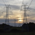
![Sunset over Montgomery Village [01]](../../../i/upload/2024/11/20/20241120093359-6e4a8f21-sq.jpg)
![Sunset over Montgomery Village [02]](../../../i/upload/2024/11/20/20241120093408-5c11a279-sq.jpg)

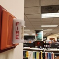
![Fire alarm pull station at Barnes & Noble in Charlottesville, Virginia [01]](../../../i/upload/2024/11/24/20241124095207-6c6973b8-sq.jpg)
![Fire alarm pull station at Barnes & Noble in Charlottesville, Virginia [02]](../../../i/upload/2024/11/24/20241124095211-9defb325-sq.jpg)
![Aerial view of Fort Defiance, Virginia [01]](../../../i/upload/2024/11/27/20241127094250-78a7561d-sq.jpg)
![Aerial view of Fort Defiance, Virginia [02]](../../../i/upload/2024/11/27/20241127094254-f1257220-sq.jpg)


![Gas cover along State Road [01]](../../../i/upload/2024/11/29/20241129122020-62839b0f-sq.jpg)
![Gas cover along State Road [02]](../../../i/upload/2024/11/29/20241129122106-62208036-sq.jpg)


![Fire at Aggregate Industries quarry [01]](../../../i/upload/2024/12/25/20241225002941-9f8a343a-sq.jpg)
![Fire at Aggregate Industries quarry [02]](../../../i/upload/2024/12/25/20241225002950-4ff900f3-sq.jpg)
![Fire at Aggregate Industries quarry [03]](../../../i/upload/2024/12/25/20241225002959-22d28c07-sq.jpg)
![Fire at Aggregate Industries quarry [04]](../../../i/upload/2024/12/25/20241225003009-8b569132-sq.jpg)
![Fire at Aggregate Industries quarry [05]](../../../i/upload/2024/12/25/20241225003018-cee46523-sq.jpg)
![Fire at Aggregate Industries quarry [06]](../../../i/upload/2024/12/25/20241225003029-dbba04bc-sq.jpg)
![Fire at Aggregate Industries quarry [07]](../../../i/upload/2024/12/25/20241225003039-43d93ed2-sq.jpg)
![Fire at Aggregate Industries quarry [08]](../../../i/upload/2024/12/25/20241225003049-74b14b99-sq.jpg)
![Fire at Aggregate Industries quarry [09]](../../../i/upload/2024/12/25/20241225003059-a1a180c5-sq.jpg)
![Fire at Aggregate Industries quarry [10]](../../../i/upload/2024/12/25/20241225003109-05f02075-sq.jpg)
![Fire at Aggregate Industries quarry [11]](../../../i/upload/2024/12/25/20241225003120-121dc2e6-sq.jpg)
![Fire at Aggregate Industries quarry [12]](../../../i/upload/2024/12/25/20241225003131-a180fa10-sq.jpg)
![Fire at Aggregate Industries quarry [13]](../../../i/upload/2024/12/25/20241225003140-877ad120-sq.jpg)
![Fire at Aggregate Industries quarry [14]](../../../i/upload/2024/12/25/20241225003152-bb2adfeb-sq.jpg)
![Fire at Aggregate Industries quarry [15]](../../../i/upload/2024/12/25/20241225003201-9c9796ad-sq.jpg)
![Fire at Aggregate Industries quarry [16]](../../../i/upload/2024/12/25/20241225003212-9fa6bddb-sq.jpg)
![Fire at Aggregate Industries quarry [17]](../../../i/upload/2024/12/25/20241225003221-553c3485-sq.jpg)
![Fire at Aggregate Industries quarry [18]](../../../i/upload/2024/12/25/20241225003230-9cc5b4d8-sq.jpg)


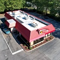
![The Smokey Griddle Pancake House [01]](../../../i/upload/2025/02/22/20250222002528-6da37f2e-sq.jpg)
![The Smokey Griddle Pancake House [02]](../../../i/upload/2025/02/22/20250222002533-769cba1b-sq.jpg)
![Traffic circle under construction [01]](../../../i/upload/2025/02/22/20250222022330-4bbf063c-sq.jpg)
![Traffic circle under construction [02]](../../../i/upload/2025/02/22/20250222022336-e9f87960-sq.jpg)
![Traffic circle under construction [03]](../../../i/upload/2025/02/22/20250222022342-e895dd00-sq.jpg)


![McDonald's sign over Thornburg, Virginia [01]](../../../i/upload/2025/02/22/20250222022358-f51fc26f-sq.jpg)
![McDonald's sign over Thornburg, Virginia [02]](../../../i/upload/2025/02/22/20250222022404-2c8132fe-sq.jpg)
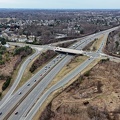
![Thornburg interchange on Interstate 95 [01]](../../../i/upload/2025/02/22/20250222022415-31ccb499-sq.jpg)
![Thornburg interchange on Interstate 95 [02]](../../../i/upload/2025/02/22/20250222022420-229d3507-sq.jpg)


![Railroad tracks between River Road and US 22/322 [01]](../../../i/upload/2025/03/06/20250306070020-014fa221-sq.jpg)
![Railroad tracks between River Road and US 22/322 [02]](../../../i/upload/2025/03/06/20250306070027-be1a89b1-sq.jpg)

Information
- Author
- Ben Schumin
- Copyright
- All Rights Reserved
- Created on
- Saturday 1 June 2024
- Dimensions
- 8064*4536
EXIF Metadata
DJI FC8282
f/170/100
1/2000
200
0/10
0
- DateTimeOriginal
- 2024:06:01 18:40:03
- DateTimeDigitized
- 2024:06:01 18:40:03
- Make
- DJI
- Model
- FC8282
- ExposureProgram
- 2
- FocalLengthIn35mmFilm
- 24
- FNumber
- 170/100
- ExposureTime
- 1/2000
- ISOSpeedRatings
- 200
- Flash
- 0
- WhiteBalance
- 0
- XResolution
- 720000/10000
- YResolution
- 720000/10000
- ImageWidth
- 8064
- ImageLength
- 4536
- Orientation
- 1
- SamplesPerPixel
- 3
- ExposureBiasValue
- 0/10
- MaxApertureValue
- 153/100
- MeteringMode
- 1
- LightSource
- 10
Powered by Piwigo