
Ben Schumin Photography Portfolio
Ben Schumin is a professional photographer who captures the intricacies of daily life.
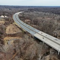
Burnt Mills Dam, on the Northwest Branch of the Anacostia River, along US 29 in Silver Spring, Maryland between Four Corners and White Oak.


![Glenmont station [02]](../../../../i/upload/2024/07/16/20240716002015-55cf0f50-sq.jpg)
![Glenmont station [03]](../../../../i/upload/2024/07/16/20240716002017-429988f6-sq.jpg)
![Silver Spring Zombie Walk 2011 [08]](../../../../i/upload/2024/07/16/20240716225425-84318776-sq.jpg)
![Silver Spring Zombie Walk 2011 [07]](../../../../i/upload/2024/07/16/20240716225431-af077a50-sq.jpg)
![Silver Spring Zombie Walk 2011 [06]](../../../../i/upload/2024/07/16/20240716225435-bbb5fe09-sq.jpg)
![Silver Spring Zombie Walk 2011 [05]](../../../../i/upload/2024/07/16/20240716225440-2b1536ab-sq.jpg)
![Silver Spring Zombie Walk 2011 [04]](../../../../i/upload/2024/07/16/20240716225444-51b5b916-sq.jpg)
![Silver Spring Zombie Walk 2011 [03]](../../../../i/upload/2024/07/16/20240716225448-7734d7ba-sq.jpg)
![Silver Spring Zombie Walk 2011 [02]](../../../../i/upload/2024/07/16/20240716225451-014d023b-sq.jpg)
![Silver Spring Zombie Walk 2011 [01]](../../../../i/upload/2024/07/16/20240716225455-e386d538-sq.jpg)
![Red Line train at Forest Glen station [01]](../../../../i/upload/2024/07/16/20240716230717-7566923c-sq.jpg)
![Red Line train at Forest Glen station [02]](../../../../i/upload/2024/07/16/20240716230724-24305eb4-sq.jpg)
![Silver Spring Zombie Walk 2011 [28]](../../../../i/upload/2024/07/16/20240716234503-62fcfa30-sq.jpg)
![Silver Spring Zombie Walk 2011 [27]](../../../../i/upload/2024/07/16/20240716234507-d91cad2e-sq.jpg)
![Silver Spring Zombie Walk 2011 [26]](../../../../i/upload/2024/07/16/20240716234510-7a90af90-sq.jpg)
![Silver Spring Zombie Walk 2011 [25]](../../../../i/upload/2024/07/16/20240716234514-0ac3fe11-sq.jpg)
![Silver Spring Zombie Walk 2011 [24]](../../../../i/upload/2024/07/16/20240716234518-cb12984c-sq.jpg)
![Silver Spring Zombie Walk 2011 [23]](../../../../i/upload/2024/07/16/20240716234522-90eda298-sq.jpg)
![Silver Spring Zombie Walk 2011 [22]](../../../../i/upload/2024/07/16/20240716234526-60209c7d-sq.jpg)
![Silver Spring Zombie Walk 2011 [21]](../../../../i/upload/2024/07/16/20240716234530-3656c781-sq.jpg)
![Silver Spring Zombie Walk 2011 [20]](../../../../i/upload/2024/07/16/20240716234534-d264afbe-sq.jpg)
![Silver Spring Zombie Walk 2011 [19]](../../../../i/upload/2024/07/16/20240716234538-a479763a-sq.jpg)
![Silver Spring Zombie Walk 2011 [18]](../../../../i/upload/2024/07/16/20240716234542-1c263a28-sq.jpg)
![Silver Spring Zombie Walk 2011 [17]](../../../../i/upload/2024/07/16/20240716234545-8294b2a0-sq.jpg)
![Silver Spring Zombie Walk 2011 [16]](../../../../i/upload/2024/07/16/20240716234550-85dca041-sq.jpg)
![Silver Spring Zombie Walk 2011 [15]](../../../../i/upload/2024/07/16/20240716234554-1278bd72-sq.jpg)
![Silver Spring Zombie Walk 2011 [14]](../../../../i/upload/2024/07/16/20240716234558-f1a5e35c-sq.jpg)
![Silver Spring Zombie Walk 2011 [13]](../../../../i/upload/2024/07/16/20240716234604-65d3e106-sq.jpg)
![Silver Spring Zombie Walk 2011 [12]](../../../../i/upload/2024/07/16/20240716234607-a299c321-sq.jpg)
![Silver Spring Zombie Walk 2011 [11]](../../../../i/upload/2024/07/16/20240716234611-85006ca2-sq.jpg)
![Silver Spring Zombie Walk 2011 [10]](../../../../i/upload/2024/07/16/20240716234615-27d87f6b-sq.jpg)
![Silver Spring Zombie Walk 2011 [09]](../../../../i/upload/2024/07/16/20240716234620-6f306ff4-sq.jpg)
![Ride On Champion 5210 [01]](../../../../i/upload/2024/07/17/20240717101547-37a9e5f9-sq.jpg)
![Ride On Champion 5210 [02]](../../../../i/upload/2024/07/17/20240717101549-9add2053-sq.jpg)
![Ride On Gillig Low Floor 5008 [02]](../../../../i/upload/2024/07/17/20240717101555-1bf3ecdb-sq.jpg)
![Ride On Gillig Low Floor 5008 [03]](../../../../i/upload/2024/07/17/20240717101558-26ae79b8-sq.jpg)
![Ride On Gillig Low Floor 5008 [01]](../../../../i/upload/2024/07/17/20240717101600-929ddca0-sq.jpg)
![2012 Kia Soul [13]](../../../../i/upload/2024/07/17/20240717101603-20541257-sq.jpg)
![2012 Kia Soul [14]](../../../../i/upload/2024/07/17/20240717101606-a21f80a3-sq.jpg)
![2012 Kia Soul [15]](../../../../i/upload/2024/07/17/20240717101609-25423b9b-sq.jpg)
![2012 Kia Soul [16]](../../../../i/upload/2024/07/17/20240717101612-365ccda5-sq.jpg)
![2012 Kia Soul [17]](../../../../i/upload/2024/07/17/20240717101614-6edecf24-sq.jpg)
![2012 Kia Soul [18]](../../../../i/upload/2024/07/17/20240717101617-baaed80e-sq.jpg)
![2012 Kia Soul [19]](../../../../i/upload/2024/07/17/20240717101620-0b841ad3-sq.jpg)
![2012 Kia Soul [20]](../../../../i/upload/2024/07/17/20240717101623-66e097f4-sq.jpg)
![Silver Spring Zombie Walk 2013 [46]](../../../../i/upload/2024/07/17/20240717165506-ee4b2713-sq.jpg)
![Silver Spring Zombie Walk 2013 [45]](../../../../i/upload/2024/07/17/20240717165509-2edfa65a-sq.jpg)
![Silver Spring Zombie Walk 2013 [44]](../../../../i/upload/2024/07/17/20240717165512-be208263-sq.jpg)
![Silver Spring Zombie Walk 2013 [43]](../../../../i/upload/2024/07/17/20240717165516-42c79dd5-sq.jpg)
![Silver Spring Zombie Walk 2013 [42]](../../../../i/upload/2024/07/17/20240717165520-c23288a9-sq.jpg)
![Silver Spring Zombie Walk 2013 [41]](../../../../i/upload/2024/07/17/20240717165524-0692420b-sq.jpg)
![Silver Spring Zombie Walk 2013 [40]](../../../../i/upload/2024/07/17/20240717165528-8c69c401-sq.jpg)
![Silver Spring Zombie Walk 2013 [39]](../../../../i/upload/2024/07/17/20240717165533-ebe22cc4-sq.jpg)
![Silver Spring Zombie Walk 2013 [38]](../../../../i/upload/2024/07/17/20240717165537-1d367d15-sq.jpg)
![Silver Spring Zombie Walk 2013 [37]](../../../../i/upload/2024/07/17/20240717165542-37679c3f-sq.jpg)
![Silver Spring Zombie Walk 2013 [36]](../../../../i/upload/2024/07/17/20240717165545-0f62753b-sq.jpg)
![Silver Spring Zombie Walk 2013 [35]](../../../../i/upload/2024/07/17/20240717165548-4eaf5580-sq.jpg)
![Silver Spring Zombie Walk 2013 [34]](../../../../i/upload/2024/07/17/20240717165552-40136041-sq.jpg)
![Silver Spring Zombie Walk 2013 [33]](../../../../i/upload/2024/07/17/20240717165557-b7bee017-sq.jpg)
![Silver Spring Zombie Walk 2013 [32]](../../../../i/upload/2024/07/17/20240717165600-b796da09-sq.jpg)
![Silver Spring Zombie Walk 2013 [31]](../../../../i/upload/2024/07/17/20240717165605-166e4c71-sq.jpg)
![Silver Spring Zombie Walk 2013 [30]](../../../../i/upload/2024/07/17/20240717165609-9e341a05-sq.jpg)
![Silver Spring Zombie Walk 2013 [29]](../../../../i/upload/2024/07/17/20240717165614-c22397ca-sq.jpg)
![Silver Spring Zombie Walk 2013 [28]](../../../../i/upload/2024/07/17/20240717165618-7d5b1082-sq.jpg)
![Silver Spring Zombie Walk 2013 [27]](../../../../i/upload/2024/07/17/20240717165622-5bdce6aa-sq.jpg)
![Silver Spring Zombie Walk 2013 [26]](../../../../i/upload/2024/07/17/20240717165625-2921cbf9-sq.jpg)
![Silver Spring Zombie Walk 2013 [25]](../../../../i/upload/2024/07/17/20240717165630-624ca8e5-sq.jpg)
![Silver Spring Zombie Walk 2013 [24]](../../../../i/upload/2024/07/17/20240717165633-cff0fc3d-sq.jpg)
![Silver Spring Zombie Walk 2013 [23]](../../../../i/upload/2024/07/17/20240717165638-c71d5a8d-sq.jpg)
![Silver Spring Zombie Walk 2013 [22]](../../../../i/upload/2024/07/17/20240717165642-6fa23d91-sq.jpg)
![Silver Spring Zombie Walk 2013 [21]](../../../../i/upload/2024/07/17/20240717165645-b079c433-sq.jpg)
![Silver Spring Zombie Walk 2013 [20]](../../../../i/upload/2024/07/17/20240717165650-30c3e6b7-sq.jpg)
![Silver Spring Zombie Walk 2013 [19]](../../../../i/upload/2024/07/17/20240717165654-e35643ff-sq.jpg)
![Silver Spring Zombie Walk 2013 [18]](../../../../i/upload/2024/07/17/20240717165657-c55f1c49-sq.jpg)
![Silver Spring Zombie Walk 2013 [17]](../../../../i/upload/2024/07/17/20240717165701-a940c94a-sq.jpg)
![Silver Spring Zombie Walk 2013 [16]](../../../../i/upload/2024/07/17/20240717165705-30a31a9d-sq.jpg)
![Silver Spring Zombie Walk 2013 [15]](../../../../i/upload/2024/07/17/20240717165709-0aa432ed-sq.jpg)
![Silver Spring Zombie Walk 2013 [14]](../../../../i/upload/2024/07/17/20240717165713-8fb62c1e-sq.jpg)
![Silver Spring Zombie Walk 2013 [13]](../../../../i/upload/2024/07/17/20240717165716-f57d71f5-sq.jpg)
![Silver Spring Zombie Walk 2013 [12]](../../../../i/upload/2024/07/17/20240717165720-7e6bd663-sq.jpg)
![Silver Spring Zombie Walk 2013 [11]](../../../../i/upload/2024/07/17/20240717165724-12112768-sq.jpg)
![Silver Spring Zombie Walk 2013 [10]](../../../../i/upload/2024/07/17/20240717165727-25634b70-sq.jpg)
![Silver Spring Zombie Walk 2013 [09]](../../../../i/upload/2024/07/17/20240717165730-70429aeb-sq.jpg)
![Silver Spring Zombie Walk 2013 [08]](../../../../i/upload/2024/07/17/20240717165733-1a89e559-sq.jpg)
![Silver Spring Zombie Walk 2013 [07]](../../../../i/upload/2024/07/17/20240717165737-a5106c99-sq.jpg)
![Silver Spring Zombie Walk 2013 [06]](../../../../i/upload/2024/07/17/20240717165740-e4d26a3c-sq.jpg)
![Silver Spring Zombie Walk 2013 [05]](../../../../i/upload/2024/07/17/20240717165749-e257b5c1-sq.jpg)
![Silver Spring Zombie Walk 2013 [04]](../../../../i/upload/2024/07/17/20240717165754-7637bd15-sq.jpg)
![Silver Spring Zombie Walk 2013 [03]](../../../../i/upload/2024/07/17/20240717165757-e4daf8e2-sq.jpg)
![Silver Spring Zombie Walk 2013 [02]](../../../../i/upload/2024/07/17/20240717165801-64e1d175-sq.jpg)
![Silver Spring Zombie Walk 2013 [01]](../../../../i/upload/2024/07/17/20240717165804-482c2b14-sq.jpg)
![Plungefest 2014 [04]](../../../../i/upload/2024/07/17/20240717224414-0c74bfbd-sq.jpg)
![Plungefest 2014 [05]](../../../../i/upload/2024/07/17/20240717224418-55454e3d-sq.jpg)
![Plungefest 2014 [06]](../../../../i/upload/2024/07/17/20240717224422-01d2615e-sq.jpg)
![Plungefest 2014 [07]](../../../../i/upload/2024/07/17/20240717224426-ae37204a-sq.jpg)
![Plungefest 2014 [08]](../../../../i/upload/2024/07/17/20240717224431-a5934c2a-sq.jpg)
![Plungefest 2014 [16]](../../../../i/upload/2024/07/17/20240717224457-1e9b45a2-sq.jpg)
![Metrobus 5431 at Silver Spring Transit Center [02]](../../../../i/upload/2024/07/18/20240718213556-5840a39c-sq.jpg)
![Metrobus 5431 at Silver Spring Transit Center [01]](../../../../i/upload/2024/07/18/20240718213559-052491af-sq.jpg)

![Adaire apartment building [08]](../../../../i/upload/2024/07/19/20240719101105-3ae9d8d2-sq.jpg)
![Burnt Mills Dam [01]](../../../../i/upload/2024/07/19/20240719101253-1d0e8fd4-sq.jpg)
![Burnt Mills Dam [02]](../../../../i/upload/2024/07/19/20240719101258-fdd0aceb-sq.jpg)
![Burnt Mills Dam [08]](../../../../i/upload/2024/07/19/20240719101304-3d6b6b84-sq.jpg)
![Burnt Mills Dam [07]](../../../../i/upload/2024/07/19/20240719101310-68ca36a5-sq.jpg)
![Burnt Mills Dam [06]](../../../../i/upload/2024/07/19/20240719101316-964f13d0-sq.jpg)
![Burnt Mills Dam [05]](../../../../i/upload/2024/07/19/20240719101322-6e7c4f7c-sq.jpg)
![Burnt Mills Dam [04]](../../../../i/upload/2024/07/19/20240719101327-824e73b8-sq.jpg)
![Burnt Mills Dam [03]](../../../../i/upload/2024/07/19/20240719101332-fd5d1720-sq.jpg)

![Sears in White Oak, Maryland [02]](../../../../i/upload/2024/07/19/20240719101343-a4c82705-sq.jpg)
![Sears in White Oak, Maryland [01]](../../../../i/upload/2024/07/19/20240719101346-56359d2d-sq.jpg)
![Photographing Burnt Mills Dam [02]](../../../../i/upload/2024/07/19/20240719101349-5649e11a-sq.jpg)
![Photographing Burnt Mills Dam [01]](../../../../i/upload/2024/07/19/20240719101353-cb3c77d4-sq.jpg)
![Closing Kmart store in Aspen Hill, Maryland [02]](../../../../i/upload/2024/07/19/20240719155711-5936b686-sq.jpg)
![Closing Kmart store in Aspen Hill, Maryland [03]](../../../../i/upload/2024/07/19/20240719155716-bfbac476-sq.jpg)
![Ceiling air vent at the Kmart store in Aspen Hill, Maryland [01]](../../../../i/upload/2024/07/19/20240719155721-ba21582e-sq.jpg)
![Ceiling air vent at the Kmart store in Aspen Hill, Maryland [02]](../../../../i/upload/2024/07/19/20240719155727-c56ee154-sq.jpg)
![Former pharmacy at the Kmart store in Aspen Hill, Maryland [02]](../../../../i/upload/2024/07/19/20240719155732-d8b3e21b-sq.jpg)
![Closing Kmart store in Aspen Hill, Maryland [04]](../../../../i/upload/2024/07/19/20240719155737-03511623-sq.jpg)
![Former pharmacy at the Kmart store in Aspen Hill, Maryland [01]](../../../../i/upload/2024/07/19/20240719155742-dfddcc66-sq.jpg)
![Closing Kmart store in Aspen Hill, Maryland [01]](../../../../i/upload/2024/07/19/20240719155746-dc7909e9-sq.jpg)

![Monopine-style cell tower near National Capital Trolley Museum [01]](../../../../i/upload/2024/12/24/20241224101944-cb5368ee-sq.jpg)
![Monopine-style cell tower near National Capital Trolley Museum [02]](../../../../i/upload/2024/12/24/20241224101954-885b79da-sq.jpg)
![Monopine-style cell tower near National Capital Trolley Museum [03]](../../../../i/upload/2024/12/24/20241224102006-8f317b4f-sq.jpg)
![Monopine-style cell tower near National Capital Trolley Museum [04]](../../../../i/upload/2024/12/24/20241224102019-bf90559d-sq.jpg)
![Monopine-style cell tower near National Capital Trolley Museum [05]](../../../../i/upload/2024/12/24/20241224102032-db8ea39c-sq.jpg)
![Monopine-style cell tower near National Capital Trolley Museum [06]](../../../../i/upload/2024/12/24/20241224102042-4bf27826-sq.jpg)

![Former Fairfax Connector bus 7754 [04]](../../../../i/upload/2025/01/03/20250103235702-0ff8612f-sq.jpg)
Information
- Author
- Ben Schumin
- Copyright
- All Rights Reserved
- Created on
- Sunday 29 March 2020
- Dimensions
- 6000*4000
Powered by Piwigo