
Ben Schumin Photography Portfolio
Ben Schumin is a professional photographer who captures the intricacies of daily life.
Burnt Mills Dam, on the Northwest Branch of the Anacostia River, along US 29 in Silver Spring, Maryland between Four Corners and White Oak.


![Beach along Lake Michigan [02]](../../../../i/upload/2024/07/16/20240716232620-b1ff519c-sq.jpg)
![Chicago as viewed from the John Hancock Center [01]](../../../../i/upload/2024/07/16/20240716232625-6f99ff8a-sq.jpg)

![Lifesaving rowboat [02]](../../../../i/upload/2024/07/16/20240716232757-79d38bc1-sq.jpg)


![Dogs in Lake Michigan [01]](../../../../i/upload/2024/07/16/20240716232822-8708ebe2-sq.jpg)
![Dogs in Lake Michigan [02]](../../../../i/upload/2024/07/16/20240716232825-48a5d303-sq.jpg)

![Lifesaving rowboat [01]](../../../../i/upload/2024/07/16/20240716232832-e7d69a16-sq.jpg)
![Dog retrieving an object in Lake Michigan [01]](../../../../i/upload/2024/07/17/20240717102303-51705fb2-sq.jpg)
![Dog retrieving an object in Lake Michigan [02]](../../../../i/upload/2024/07/17/20240717102307-de9c7a86-sq.jpg)
![Dog retrieving an object in Lake Michigan [04]](../../../../i/upload/2024/07/17/20240717102342-ee7a356d-sq.jpg)
![Dog retrieving an object in Lake Michigan [03]](../../../../i/upload/2024/07/17/20240717102345-42421fc6-sq.jpg)


![Cloudy skies over Lake Michigan [03]](../../../../i/upload/2024/07/17/20240717160708-fc8bdc4b-sq.jpg)
![Cloudy skies over Lake Michigan [04]](../../../../i/upload/2024/07/17/20240717160714-d52fcd77-sq.jpg)
![Brighton Dam [01]](../../../../i/upload/2024/07/17/20240717162258-f327a257-sq.jpg)
![Brighton Dam [02]](../../../../i/upload/2024/07/17/20240717162301-722a8f72-sq.jpg)
![Asbury Park Heating Plant [02]](../../../../i/upload/2024/07/17/20240717165350-fc6cf8cb-sq.jpg)
![Brighton Dam [03]](../../../../i/upload/2024/07/17/20240717174519-e831b71b-sq.jpg)
![Brighton Dam [04]](../../../../i/upload/2024/07/17/20240717174522-b44df259-sq.jpg)
![Brighton Dam [05]](../../../../i/upload/2024/07/17/20240717174524-356257f1-sq.jpg)
![Brighton Dam [06]](../../../../i/upload/2024/07/17/20240717174530-ae829a2e-sq.jpg)
![Brighton Dam [07]](../../../../i/upload/2024/07/17/20240717225008-f4afcc53-sq.jpg)


![Triadelphia Reservoir [01]](../../../../i/upload/2024/07/17/20240717225030-1dfafa55-sq.jpg)

![Triadelphia Reservoir [02]](../../../../i/upload/2024/07/17/20240717225036-4cf2b422-sq.jpg)
![Barbed wire [01]](../../../../i/upload/2024/07/17/20240717225043-78a5434c-sq.jpg)
![Barbed wire [02]](../../../../i/upload/2024/07/17/20240717225046-545942a1-sq.jpg)
![Brighton Dam Road [01]](../../../../i/upload/2024/07/17/20240717225049-0f96c3b6-sq.jpg)
![Brighton Dam Road [02]](../../../../i/upload/2024/07/17/20240717225052-1b323317-sq.jpg)
![Brighton Dam Road [03]](../../../../i/upload/2024/07/17/20240717225056-ac7d70e4-sq.jpg)
![Brighton Dam Road [04]](../../../../i/upload/2024/07/17/20240717225100-7f927d75-sq.jpg)
![Barbed wire [03]](../../../../i/upload/2024/07/17/20240717225104-b9400cf2-sq.jpg)
![Little Seneca Lake [01]](../../../../i/upload/2024/07/17/20240717225231-fe47ff45-sq.jpg)
![Little Seneca Lake [02]](../../../../i/upload/2024/07/17/20240717225234-2d024af5-sq.jpg)
![Tire track in the mud [01]](../../../../i/upload/2024/07/17/20240717225556-8621b514-sq.jpg)
![Tire track in the mud [02]](../../../../i/upload/2024/07/17/20240717225559-312853a3-sq.jpg)
![North end of Lake Artemesia [01]](../../../../i/upload/2024/07/17/20240717225603-3d151a07-sq.jpg)
![North end of Lake Artemesia [02]](../../../../i/upload/2024/07/17/20240717225606-388cdd99-sq.jpg)
![North end of Lake Artemesia [03]](../../../../i/upload/2024/07/17/20240717225608-75f55469-sq.jpg)


![Otter Lake [01]](../../../../i/upload/2024/07/17/20240717232237-c86a9de5-sq.jpg)
![Otter Lake [02]](../../../../i/upload/2024/07/17/20240717232240-d588e3c0-sq.jpg)

![Otter Lake [03]](../../../../i/upload/2024/07/17/20240717233001-54629e8c-sq.jpg)
![Otter Lake [04]](../../../../i/upload/2024/07/17/20240717233006-67335ad2-sq.jpg)
![Burnt Mills Dam [01]](../../../../i/upload/2024/07/19/20240719101253-1d0e8fd4-sq.jpg)
![Burnt Mills Dam [02]](../../../../i/upload/2024/07/19/20240719101258-fdd0aceb-sq.jpg)
![Burnt Mills Dam [08]](../../../../i/upload/2024/07/19/20240719101304-3d6b6b84-sq.jpg)
![Burnt Mills Dam [07]](../../../../i/upload/2024/07/19/20240719101310-68ca36a5-sq.jpg)
![Burnt Mills Dam [06]](../../../../i/upload/2024/07/19/20240719101316-964f13d0-sq.jpg)
![Burnt Mills Dam [05]](../../../../i/upload/2024/07/19/20240719101322-6e7c4f7c-sq.jpg)
![Burnt Mills Dam [04]](../../../../i/upload/2024/07/19/20240719101327-824e73b8-sq.jpg)
![Burnt Mills Dam [03]](../../../../i/upload/2024/07/19/20240719101332-fd5d1720-sq.jpg)
![Photographing Burnt Mills Dam [02]](../../../../i/upload/2024/07/19/20240719101349-5649e11a-sq.jpg)
![Photographing Burnt Mills Dam [01]](../../../../i/upload/2024/07/19/20240719101353-cb3c77d4-sq.jpg)
![Hampton Coliseum at night [03]](../../../../i/upload/2024/07/19/20240719101950-f2636558-sq.jpg)
![Hampton Coliseum at night [02]](../../../../i/upload/2024/07/19/20240719101954-31c8baac-sq.jpg)
![Hampton Coliseum at night [01]](../../../../i/upload/2024/07/19/20240719101959-d397a8f9-sq.jpg)
![Hampton Coliseum [02]](../../../../i/upload/2024/07/19/20240719102031-e2e1e7c9-sq.jpg)
![Hampton Coliseum [01]](../../../../i/upload/2024/07/19/20240719102036-84406fea-sq.jpg)
![Hampton Coliseum [03]](../../../../i/upload/2024/07/19/20240719102041-6ddfd090-sq.jpg)
![Brighton Dam [10]](../../../../i/upload/2024/07/19/20240719110520-89caa82b-sq.jpg)
![Brighton Dam [09]](../../../../i/upload/2024/07/19/20240719110525-a5167be8-sq.jpg)
![Brighton Dam [08]](../../../../i/upload/2024/07/19/20240719110529-8ccb0379-sq.jpg)

![Lake Marion Community Center pool [01]](../../../../i/upload/2024/07/19/20240719122840-4a4f2348-sq.jpg)
![Lake Marion Community Center pool [02]](../../../../i/upload/2024/07/19/20240719122844-861bf93b-sq.jpg)
![Lake Marion Community Center pool [03]](../../../../i/upload/2024/07/19/20240719122848-aec9a0dc-sq.jpg)
![Lake Marion Community Center pool [04]](../../../../i/upload/2024/07/19/20240719122852-e7a00446-sq.jpg)
![Retention pond at Waynesboro Town Center [06]](../../../../i/upload/2024/07/19/20240719163956-ef793988-sq.jpg)
![Retention pond at Waynesboro Town Center [02]](../../../../i/upload/2024/07/19/20240719164015-5194b057-sq.jpg)
![Retention pond at Waynesboro Town Center [04]](../../../../i/upload/2024/07/19/20240719164033-d6b7da56-sq.jpg)
![Retention pond at Waynesboro Town Center [01]](../../../../i/upload/2024/07/19/20240719164038-b00f3aae-sq.jpg)
![Retention pond at Waynesboro Town Center [05]](../../../../i/upload/2024/07/19/20240719164048-d9716b78-sq.jpg)
![Retention pond at Waynesboro Town Center [03]](../../../../i/upload/2024/07/19/20240719164105-ab16abc4-sq.jpg)
![Little Seneca Dam [08]](../../../../i/upload/2024/07/19/20240719164853-d8db1427-sq.jpg)
![Little Seneca Dam [01]](../../../../i/upload/2024/07/19/20240719164857-c0b348d8-sq.jpg)
![Little Seneca Dam [06]](../../../../i/upload/2024/07/19/20240719164901-310db068-sq.jpg)
![Little Seneca Dam [02]](../../../../i/upload/2024/07/19/20240719164905-4f22f45b-sq.jpg)
![Clarksburg Road bridge over Little Seneca Lake [04]](../../../../i/upload/2024/07/19/20240719164909-eab2208d-sq.jpg)
![Clarksburg Road bridge over Little Seneca Lake [03]](../../../../i/upload/2024/07/19/20240719164913-53b65146-sq.jpg)
![Clarksburg Road bridge over Little Seneca Lake [01]](../../../../i/upload/2024/07/19/20240719164917-35ced0ed-sq.jpg)
![Little Seneca Lake [03]](../../../../i/upload/2024/07/19/20240719164921-f37b3e1f-sq.jpg)
![Little Seneca Dam [03]](../../../../i/upload/2024/07/19/20240719164924-90339ea5-sq.jpg)
![Clarksburg Road bridge over Little Seneca Lake [02]](../../../../i/upload/2024/07/19/20240719164928-43aa6e0f-sq.jpg)
![Little Seneca Dam [09]](../../../../i/upload/2024/07/19/20240719164932-bb3678b5-sq.jpg)
![Little Seneca Dam [04]](../../../../i/upload/2024/07/19/20240719164935-04afdc7e-sq.jpg)
![Little Seneca Dam [07]](../../../../i/upload/2024/07/19/20240719164939-c938727e-sq.jpg)
![Little Seneca Dam [05]](../../../../i/upload/2024/07/19/20240719164943-54bff3e5-sq.jpg)
![Clarksburg Road bridge over Little Seneca Lake [05]](../../../../i/upload/2024/07/19/20240719164946-4e860e8a-sq.jpg)
![Lake Manassas Dam [02]](../../../../i/upload/2024/07/19/20240719165006-b0ff7220-sq.jpg)
![Lake Manassas Dam [05]](../../../../i/upload/2024/07/19/20240719165011-47529c6c-sq.jpg)
![Lake Manassas Dam [04]](../../../../i/upload/2024/07/19/20240719165152-c2d9b171-sq.jpg)
![Lake Manassas Dam [01]](../../../../i/upload/2024/07/19/20240719165229-6fac0b4e-sq.jpg)
![Lake Manassas Dam [03]](../../../../i/upload/2024/07/19/20240719165346-295a7955-sq.jpg)
![Lake Marion Community Center pool [06]](../../../../i/upload/2024/07/19/20240719165432-05e5d3a1-sq.jpg)
![Lake Marion Community Center pool [05]](../../../../i/upload/2024/07/19/20240719165437-13657538-sq.jpg)
![North bank of the James River [01]](../../../../i/upload/2024/07/19/20240719203203-43675d31-sq.jpg)
![North bank of the James River [02]](../../../../i/upload/2024/07/19/20240719203208-f0ca844f-sq.jpg)
![North bank of the James River [03]](../../../../i/upload/2024/07/19/20240719203213-033820a2-sq.jpg)
![T. Howard Duckett Dam [04]](../../../../i/upload/2024/07/19/20240719212246-7e257bd1-sq.jpg)
![T. Howard Duckett Dam [02]](../../../../i/upload/2024/07/19/20240719212251-938cb19b-sq.jpg)
![T. Howard Duckett Dam [03]](../../../../i/upload/2024/07/19/20240719212257-b321fde2-sq.jpg)
![T. Howard Duckett Dam [01]](../../../../i/upload/2024/07/19/20240719212329-74701062-sq.jpg)
![T. Howard Duckett Dam [05]](../../../../i/upload/2024/07/19/20240719212334-6e3c2a99-sq.jpg)
![Lake Whetstone [01]](../../../../i/upload/2024/07/19/20240719212509-f00f0226-sq.jpg)
![Lake Whetstone [02]](../../../../i/upload/2024/07/19/20240719212514-30bc8c95-sq.jpg)
![Lookout Place [01]](../../../../i/upload/2024/07/19/20240719212518-17d93411-sq.jpg)
![Lookout Place [02]](../../../../i/upload/2024/07/19/20240719212523-0f397961-sq.jpg)
![Coles Run Reservoir [05]](../../../../i/upload/2024/07/20/20240720094442-b7fc142b-sq.jpg)

![Coles Run Reservoir and Dam [03]](../../../../i/upload/2024/07/20/20240720094453-45865af9-sq.jpg)
![Coles Run Reservoir and Dam [04]](../../../../i/upload/2024/07/20/20240720094458-05426f6f-sq.jpg)
![Coles Run Reservoir [06]](../../../../i/upload/2024/07/20/20240720094503-ed97cdcc-sq.jpg)
![Coles Run Reservoir and Dam [01]](../../../../i/upload/2024/07/20/20240720094509-20eb1708-sq.jpg)
![Coles Run Reservoir [01]](../../../../i/upload/2024/07/20/20240720094619-828ab63a-sq.jpg)
![Coles Run Reservoir [02]](../../../../i/upload/2024/07/20/20240720094625-36f148ac-sq.jpg)
![Coles Run Reservoir and Dam [02]](../../../../i/upload/2024/07/20/20240720094630-6787809c-sq.jpg)
![Survey point at Coles Run Reservoir [02]](../../../../i/upload/2024/07/20/20240720094635-d2321287-sq.jpg)
![Large dandelion next to Coles Run Reservoir [01]](../../../../i/upload/2024/07/20/20240720094640-bd77775f-sq.jpg)
![Large dandelion next to Coles Run Reservoir [02]](../../../../i/upload/2024/07/20/20240720094645-e598225b-sq.jpg)
![Large dandelion next to Coles Run Reservoir [03]](../../../../i/upload/2024/07/20/20240720094650-1589d34e-sq.jpg)
![Coles Run Reservoir [04]](../../../../i/upload/2024/07/20/20240720094737-53d9fdc6-sq.jpg)

![Coles Run Reservoir [07]](../../../../i/upload/2024/07/20/20240720094748-da81fa4e-sq.jpg)

![Coles Run Reservoir [03]](../../../../i/upload/2024/07/20/20240720094756-eba3353a-sq.jpg)
![Survey point at Coles Run Reservoir [01]](../../../../i/upload/2024/07/20/20240720094812-491cbdf1-sq.jpg)
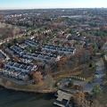
![Aerial view of Shenandoah Acres [01]](../../../../i/upload/2024/07/20/20240720103740-ebc9c8eb-sq.jpg)
![Aerial view of Shenandoah Acres [02]](../../../../i/upload/2024/07/20/20240720103746-be0c8296-sq.jpg)
![Mills Creek Reservoir [03]](../../../../i/upload/2024/07/20/20240720111031-f30a8a16-sq.jpg)
![Mills Creek Reservoir [06]](../../../../i/upload/2024/07/20/20240720111036-de4d2b3c-sq.jpg)
![Mills Creek Reservoir [11]](../../../../i/upload/2024/07/20/20240720111042-c6c6cae5-sq.jpg)
![Sherando Lake [02]](../../../../i/upload/2024/07/20/20240720111103-fdc10257-sq.jpg)
![Sherando Lake [04]](../../../../i/upload/2024/07/20/20240720111109-3c71590a-sq.jpg)
![Sherando Lake [05]](../../../../i/upload/2024/07/20/20240720111114-4ec2c76a-sq.jpg)
![Sherando Lake [09]](../../../../i/upload/2024/07/20/20240720111120-d0f93192-sq.jpg)
![Sherando Lake [11]](../../../../i/upload/2024/07/20/20240720111125-b92e902d-sq.jpg)
![Mills Creek Reservoir [05]](../../../../i/upload/2024/07/20/20240720111158-9388aaf1-sq.jpg)
![Mills Creek Reservoir [07]](../../../../i/upload/2024/07/20/20240720111203-28f1fe34-sq.jpg)
![Mills Creek Reservoir [12]](../../../../i/upload/2024/07/20/20240720111208-bf840d1d-sq.jpg)
![Mills Creek Reservoir [14]](../../../../i/upload/2024/07/20/20240720111214-2ae11afe-sq.jpg)

![Sherando Lake [10]](../../../../i/upload/2024/07/20/20240720111224-761f9e3b-sq.jpg)
![Sherando Lake [01]](../../../../i/upload/2024/07/20/20240720111230-f27e7f40-sq.jpg)
![Mills Creek Reservoir [15]](../../../../i/upload/2024/07/20/20240720111259-a7fa3afa-sq.jpg)
![Mills Creek Reservoir [17]](../../../../i/upload/2024/07/20/20240720111304-a1d46a71-sq.jpg)
![Mills Creek Reservoir [09]](../../../../i/upload/2024/07/20/20240720111310-3c4709c8-sq.jpg)
![Sherando Lake [06]](../../../../i/upload/2024/07/20/20240720111320-da75cf5c-sq.jpg)
![Sherando Lake [07]](../../../../i/upload/2024/07/20/20240720111325-8601dcba-sq.jpg)
![Mills Creek Reservoir [02]](../../../../i/upload/2024/07/20/20240720111407-0e036463-sq.jpg)
![Mills Creek Reservoir [13]](../../../../i/upload/2024/07/20/20240720111412-89dd0c1b-sq.jpg)
![Mills Creek Reservoir [18]](../../../../i/upload/2024/07/20/20240720111418-e4bc976a-sq.jpg)

![Mills Creek Reservoir [04]](../../../../i/upload/2024/07/20/20240720111430-c3120921-sq.jpg)
![Mills Creek Reservoir [01]](../../../../i/upload/2024/07/20/20240720111435-7123b9f3-sq.jpg)
![Mills Creek Reservoir [08]](../../../../i/upload/2024/07/20/20240720111441-9ed36981-sq.jpg)
![Mills Creek Reservoir [10]](../../../../i/upload/2024/07/20/20240720111446-58095189-sq.jpg)
![Mills Creek Reservoir [16]](../../../../i/upload/2024/07/20/20240720111451-f25f6dba-sq.jpg)


![Sherando Lake [03]](../../../../i/upload/2024/07/20/20240720111508-2e4ac428-sq.jpg)
![Sherando Lake [08]](../../../../i/upload/2024/07/20/20240720111513-73d7e5ca-sq.jpg)
![Douglas Lake [09]](../../../../i/upload/2024/07/20/20240720120354-dfa68809-sq.jpg)
![Douglas Lake [05]](../../../../i/upload/2024/07/20/20240720120359-cbebbc4a-sq.jpg)
![Douglas Lake [06]](../../../../i/upload/2024/07/20/20240720120405-67e59e34-sq.jpg)
![Douglas Lake [08]](../../../../i/upload/2024/07/20/20240720120417-8d600905-sq.jpg)
![Douglas Lake [11]](../../../../i/upload/2024/07/20/20240720120423-fe2fdef1-sq.jpg)

![Douglas Lake [07]](../../../../i/upload/2024/07/20/20240720120434-49f9d1b9-sq.jpg)
![Douglas Lake [03]](../../../../i/upload/2024/07/20/20240720120440-4ae673b8-sq.jpg)
![Douglas Lake [01]](../../../../i/upload/2024/07/20/20240720120446-06709267-sq.jpg)
![Douglas Lake [02]](../../../../i/upload/2024/07/20/20240720120452-7c1a4915-sq.jpg)
![Douglas Lake [10]](../../../../i/upload/2024/07/20/20240720120458-b1fbb873-sq.jpg)
![Douglas Lake [04]](../../../../i/upload/2024/07/20/20240720120503-39525604-sq.jpg)
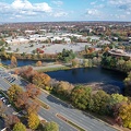
![Aerial view of Smithsburg, Maryland [01]](../../../../i/upload/2024/07/20/20240720155756-7d354d6c-sq.jpg)
![Aerial view of Smithsburg, Maryland [02]](../../../../i/upload/2024/07/20/20240720155800-cb15da92-sq.jpg)
![Mahoning Avenue at Meander Creek Reservoir [01]](../../../../i/upload/2024/10/26/20241026123754-3727f55c-sq.jpg)
![Mahoning Avenue at Meander Creek Reservoir [02]](../../../../i/upload/2024/10/26/20241026123810-fb0c700b-sq.jpg)
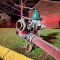
![Pipeline across Meander Creek Reservoir [01]](../../../../i/upload/2024/10/26/20241026123847-77dd0c8c-sq.jpg)
![Pipeline across Meander Creek Reservoir [02]](../../../../i/upload/2024/10/26/20241026123906-6b77f90f-sq.jpg)
![Pipeline across Meander Creek Reservoir [03]](../../../../i/upload/2024/10/26/20241026123920-1cf2f16d-sq.jpg)
![Pipeline across Meander Creek Reservoir [04]](../../../../i/upload/2024/10/26/20241026123937-7909e450-sq.jpg)
![Pipeline across Meander Creek Reservoir [05]](../../../../i/upload/2024/10/26/20241026123951-1510be5f-sq.jpg)
![Pipeline across Meander Creek Reservoir [06]](../../../../i/upload/2024/10/26/20241026124000-b2e8c282-sq.jpg)
![Pipeline across Meander Creek Reservoir [07]](../../../../i/upload/2024/10/26/20241026124007-b2ccbf65-sq.jpg)
![Pipeline across Meander Creek Reservoir [08]](../../../../i/upload/2024/10/26/20241026124015-669976bd-sq.jpg)
![Pipeline across Meander Creek Reservoir [09]](../../../../i/upload/2024/10/26/20241026124022-a0effe1c-sq.jpg)

![Aerial view from Clark Street Beach, facing south [01]](../../../../i/upload/2024/11/09/20241109111014-d364cdbf-sq.jpg)
![Aerial view from Clark Street Beach, facing south [02]](../../../../i/upload/2024/11/09/20241109111017-9276cd78-sq.jpg)
![Aerial view from Clark Street Beach, facing south [03]](../../../../i/upload/2024/11/09/20241109111021-2a94ef25-sq.jpg)
![Aerial view from Clark Street Beach, facing south [04]](../../../../i/upload/2024/11/09/20241109111026-85a83874-sq.jpg)
![Aerial view from Clark Street Beach, facing south [05]](../../../../i/upload/2024/11/09/20241109111030-e05630ba-sq.jpg)
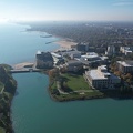
![Evanston, Illinois from over Lake Michigan [01]](../../../../i/upload/2024/11/09/20241109111034-667fc1be-sq.jpg)
![Evanston, Illinois from over Lake Michigan [02]](../../../../i/upload/2024/11/09/20241109111037-b22de27b-sq.jpg)
![Evanston, Illinois from over Lake Michigan [03]](../../../../i/upload/2024/11/09/20241109111043-a48d7f52-sq.jpg)

![Clark Street Beach [01]](../../../../i/upload/2024/11/09/20241109111108-ba883fe6-sq.jpg)
![Clark Street Beach [02]](../../../../i/upload/2024/11/09/20241109111115-aca79503-sq.jpg)
![Industrial area north of I-90 in Gary, Indiana [01]](../../../../i/upload/2024/11/16/20241116012226-8db9fe3f-sq.jpg)
![Industrial area north of I-90 in Gary, Indiana [02]](../../../../i/upload/2024/11/16/20241116012231-d5d76c80-sq.jpg)

![Interstate 64 in Hampton, Virginia [02]](../../../../i/upload/2025/02/17/20250217085501-e9021d57-sq.jpg)
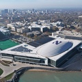
![Aerial view of Hampton Coliseum [02]](../../../../i/upload/2025/02/17/20250217085700-fbcac1cc-sq.jpg)
![Aerial view of Hampton Coliseum [01]](../../../../i/upload/2025/02/17/20250217085721-26ccc815-sq.jpg)
![Interstate 64 in Hampton, Virginia [01]](../../../../i/upload/2025/02/17/20250217090951-2400e489-sq.jpg)
Information
- Author
- Ben Schumin
- Copyright
- All Rights Reserved
- Created on
- Sunday 29 March 2020
- Dimensions
- 6000*4000
Powered by Piwigo